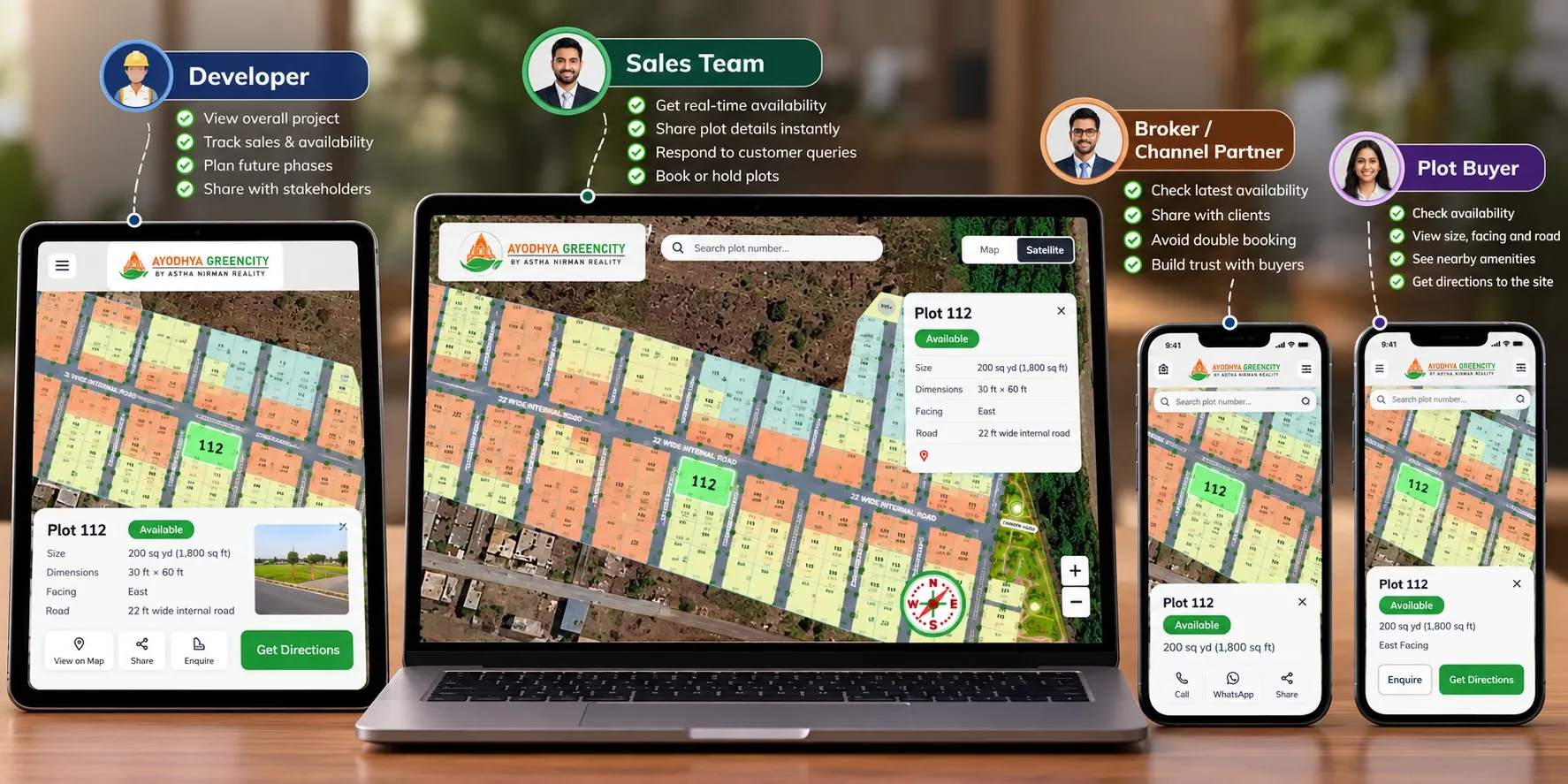
A buyer in Dubai wants to know if Plot 112 is still free. Your salesperson checks Excel. A broker in Surat has already promised it to someone else. Your marketing team is about to print a brochure that still shows it as available. Five people are asking the same question about the same plot, and each one has a different answer.
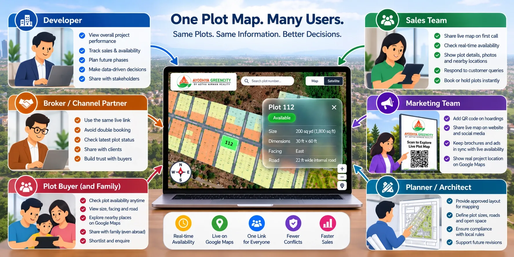
Plot mapping gives them one answer. Plot mapping is used by land developers, sales teams, marketing teams, channel partners and brokers, enterprise groups with many projects, and plot buyers. Planners and architects are part of it too, because they supply the approved layout that gets mapped. Each group uses the same plot map on Google Maps for a different job.
This guide explains who uses plot mapping, what each role needs from it and which projects benefit most.
Key takeaways
- Plot mapping is used by everyone involved in selling a plotted project, not only by the developer.
- Developers use it to see inventory and sales progress across the whole layout in one view.
- Sales teams and brokers use it to answer availability questions quickly and avoid offering a booked plot.
- Buyers use it to see where a plot sits, what surrounds it and whether it's still available, before they visit.
- The value grows with project size, number of phases and number of people selling.
What plot mapping means, in short
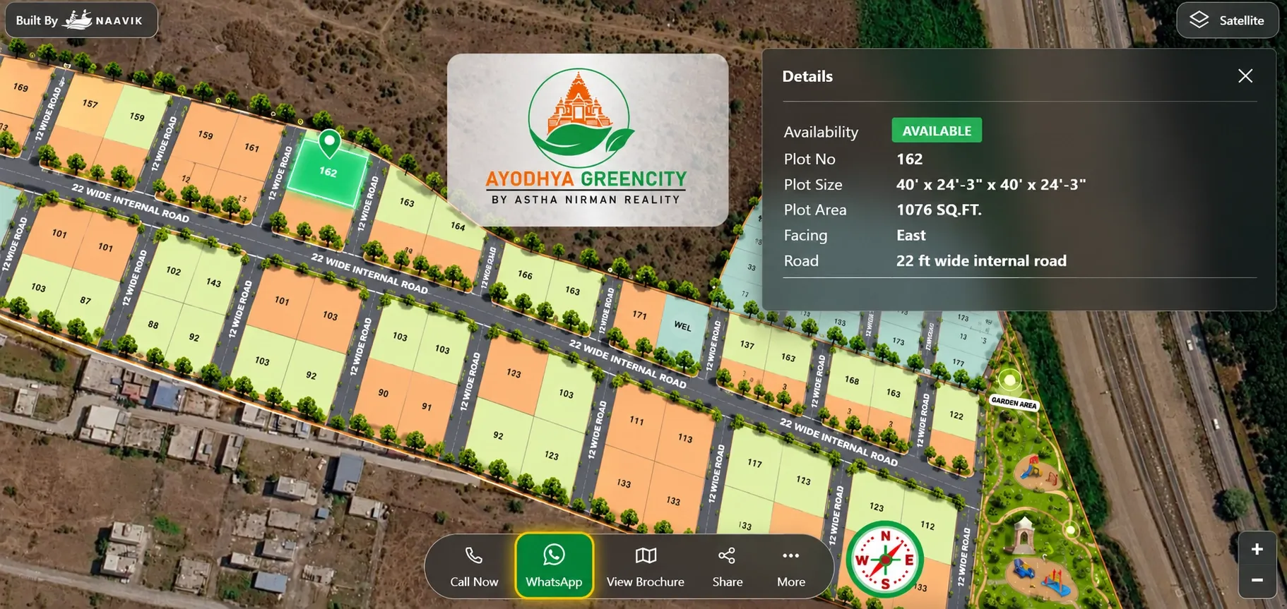
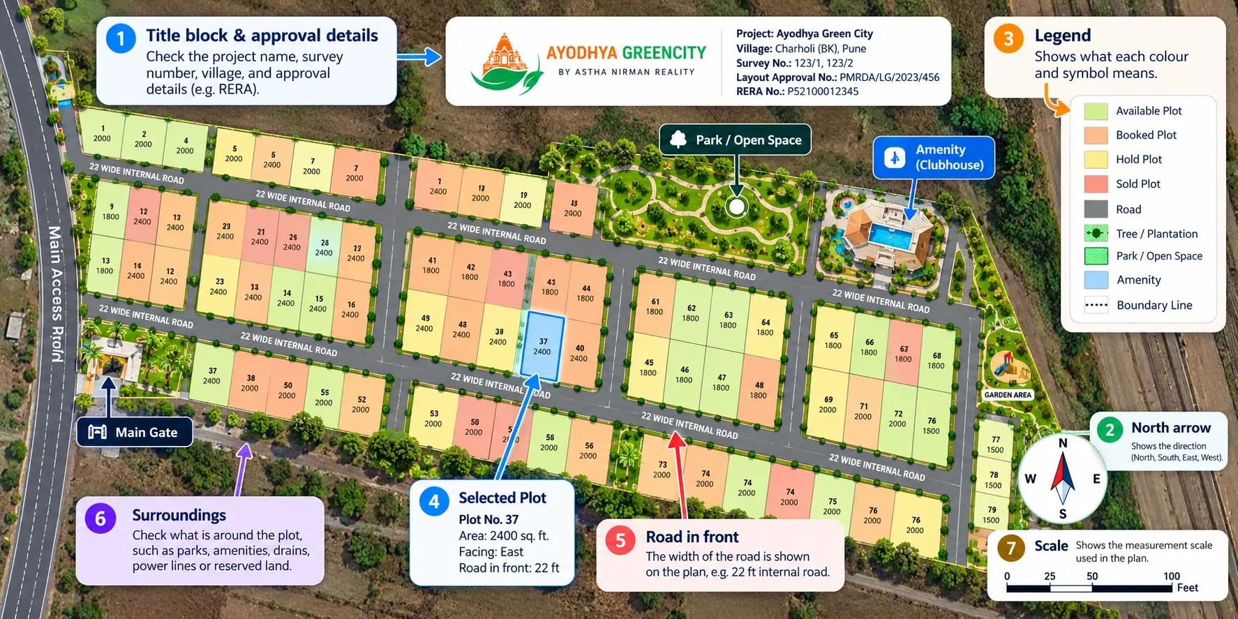
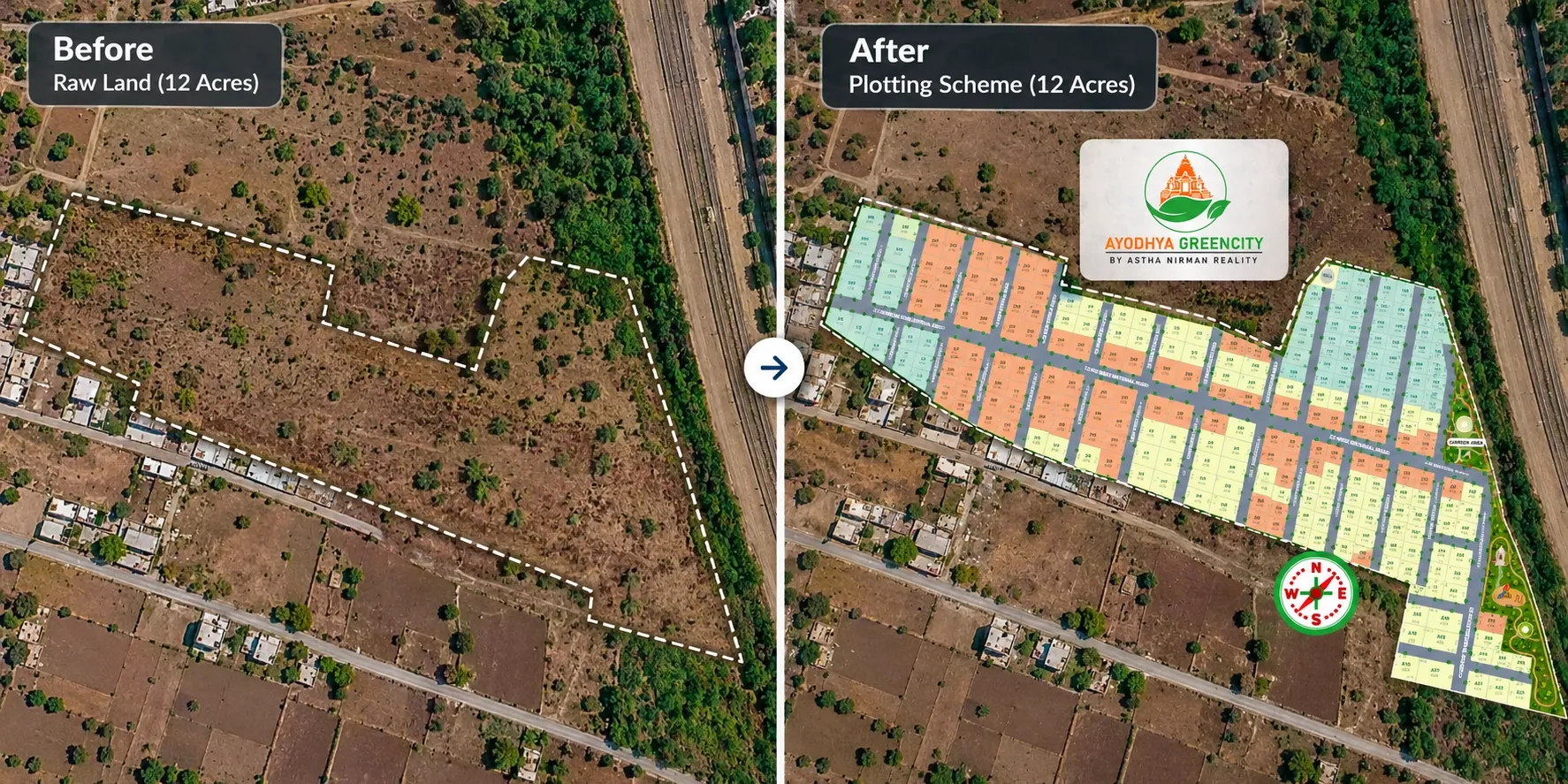
Plot mapping places your approved layout on the real location of your land on Google Maps. Every plot becomes a separate, clickable shape with its own number, size, facing and status.
On a live plot map, that status changes when a plot is booked or sold. For the full process, read our guide on how plot mapping works.
Land and plot developers
Developers are usually the ones who decide to map a project. They also gain the most from it.
Their problem
- Inventory lives in Excel sheets, registers and phone calls
- No quick way to see how much of the layout has sold, and where
- Brochures go out of date as plots sell
- Buyers ask for repeat site visits because they can't picture the layout
How they use a plot map
- To see every plot's status across the layout in one view
- To spot which pockets are selling slowly, such as inner plots or a particular phase
- To share one project link with buyers, brokers and the sales team
What changes
- Pricing and release decisions are based on what the plot map shows, not on a sheet updated last week
- Fewer site visits are spent explaining the layout
- One source of truth replaces several versions of the same file
Example question it answers: "Which east-facing plots in Phase 2 are still available?"
Sales teams
Your sales team answers the same questions every day: where is the plot, which way does it face, how wide is the road and is it free?
Their problem
- Repeating the same layout explanation on every call
- Not being sure whether a plot is still available
- Losing deals when a plot turns out to be sold already
- Risk of two salespeople booking the same plot
How they use a plot map
- To share the Google Maps link on WhatsApp during the first call
- To open the plot map on a tablet during site visits
- To check status before quoting a plot
What changes
- Calls are shorter because the buyer can see the plot while they talk
- Buyers arrive at the site with a shortlist
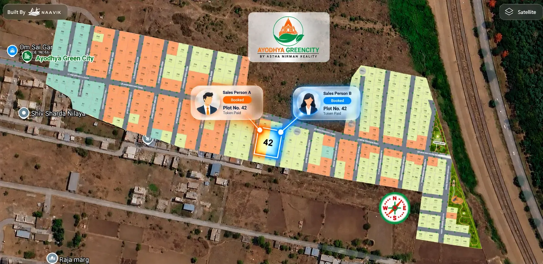
- Fewer double bookings, because everyone sees the same status
Example question it answers: "Is Plot 47 still available, and is it a corner plot?"
Marketing teams
Marketing teams spend a lot of time keeping project assets current. Every booking can make a brochure or hoarding slightly wrong.
Their problem
- Updating brochures and layout images by hand
- Campaigns that send buyers to a PDF
- Project pages that don't feel premium
How they use a plot map
- To embed the plot map on the project website
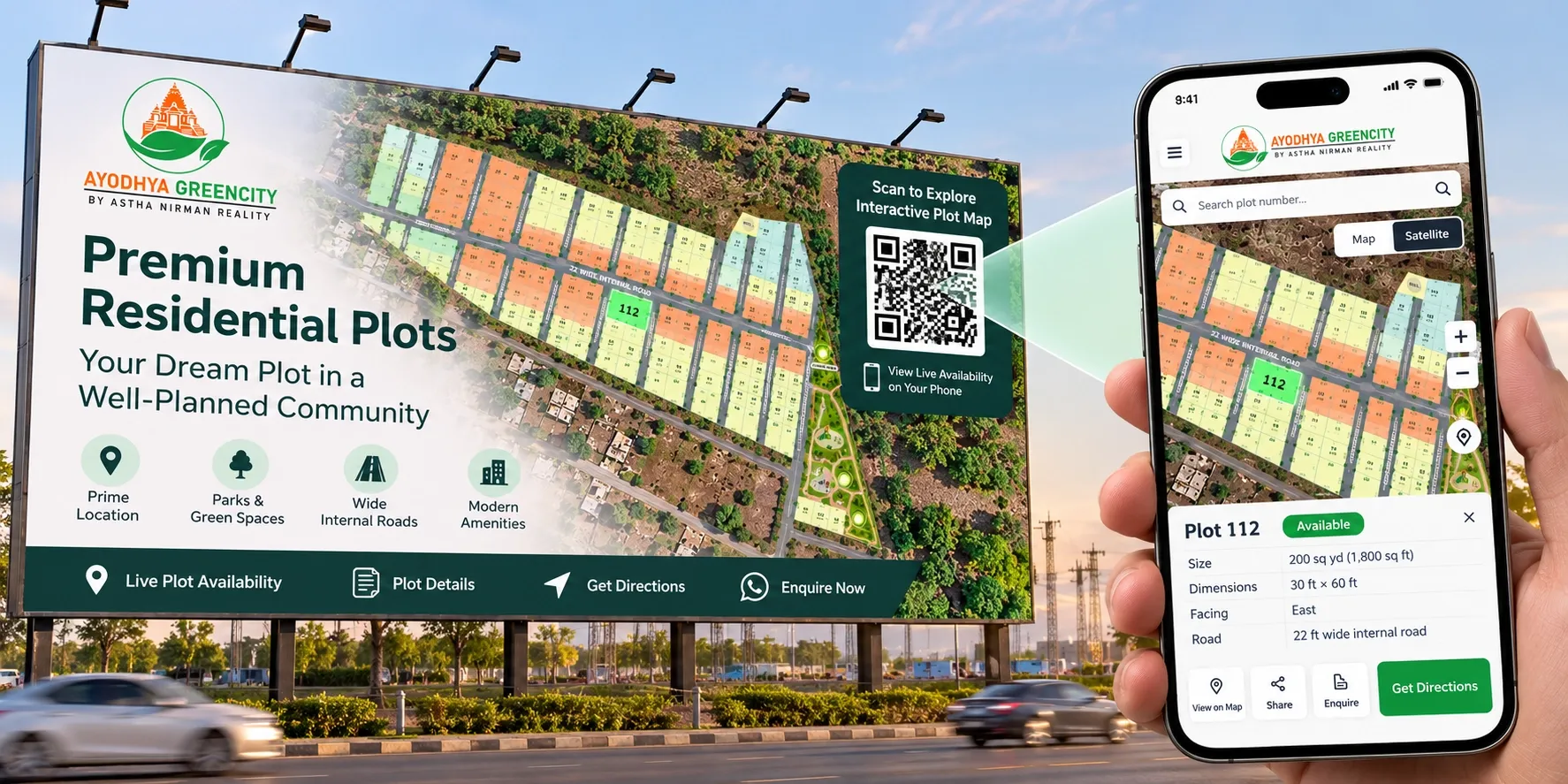
- To print a QR code on hoardings, brochures and the site office board
- To link ads and social posts to the live layout instead of a static image
What changes
- Assets stay accurate without redesigning them after every booking
- Campaign traffic lands on something buyers can explore
- The project looks more professional than a shared PDF
Example question it answers: "Can we stop reprinting the layout every time plots sell?"
Channel partners and brokers
Brokers often sell projects they didn't build. Many work with several developers at once.
Their problem
- Presenting a layout they don't know well
- Depending on the developer's office to confirm availability
- Losing credibility when they offer a plot that's already booked
How they use a plot map
- To share the same project link the developer uses
- To walk a buyer through the layout and surroundings on a phone
- To check a plot's status before making an offer
What changes
- Brokers present the project with more confidence
- Fewer conflicts between brokers and the developer's team
- Buyers get consistent information whoever they speak to
Example question it answers: "Can I offer this plot to my client today, or is it on hold?"
Enterprise groups with many projects
Groups running several plotted projects face the same problems at a larger scale, plus one more: consistency.
Their problem
- Each project tracks inventory in its own way
- Leadership can't compare projects quickly
- Buyer experience varies from one project to the next
How they use plot mapping
- To map every project the same way, with the same four statuses: available, booked, hold and sold
- To review sales progress across projects from one place
- To give every project the same professional presentation
What changes
- Reporting is faster and more comparable
- New projects launch with a familiar setup
- Buyers who know one project find the next one easy to understand
Example question it answers: "Which of our projects has the most unsold inventory right now?"
Planners and architects
Planners and architects don't usually run the plot map, but they start the process.
They draw the layout and take it through approval, deciding plot sizes, road widths and open spaces. Our guide on what a plotting scheme is covers this stage. The approved drawing they hand over becomes the base for every plot on Google Maps.
Two things from planners make mapping smoother:
- A final approved layout, ideally as a CAD file or high-quality PDF
- A plot schedule whose plot numbers and areas match the drawing exactly
If the layout changes after mapping, the plot map has to change too. Early coordination with your planner saves rework later.
Plot buyers, including NRIs
Buyers are the people plot maps are ultimately made for. They don't need any special software. A link or QR code opens the layout on Google Maps in a phone browser.
Their problem
- They can't picture a plot from a crowded PDF
- They can't judge the surroundings without travelling to the site
- They don't fully trust what they're told about availability
How they use a plot map
- To tap a plot and see its size, facing and road width
- To check nearby schools, hospitals, highways and stations
- To see which plots are still available before calling
What changes
- Buyers visit the site already knowing which plots they like
- Family members in other cities, or abroad, can review the same layout
- Decisions feel safer because availability is visible
For buyers who can't visit at all, plot maps are a key part of how developers sell plots online.
Example question it answers: "How far is this plot from the highway, and what's next to it?"
Which projects get the most value
Every plotted project benefits from plot mapping. But the gain is larger in some situations than others.
Small layouts (under 100 plots)
- Main users: the developer, a small sales team and buyers
- Main gain: buyers understand the layout and surroundings without repeat visits
- Live status matters most once two or more people are selling
Large townships and phased projects
- Main users: everyone listed above, often including several broker networks
- Main gain: one view of hundreds of plots across phases, with clear status for each
- Read more in our post on interactive masterplans for townships
Under-development and pre-launch projects
- Main users: marketing teams, brokers and early buyers
- Main gain: buyers see the location and layout before roads and gates exist
- See our pre-launch plot marketing playbook
Projects sold through many brokers
- Main users: channel partners and the developer's sales desk
- Main gain: fewer conflicts, because every broker sees the same status
Example: one project, many users near Ahmedabad
This is an illustrative example, not a client case.
A developer has a 220-plot residential project of about 14 acres near Ahmedabad. Plots range from 120 to 250 sq yd. The developer has three in-house salespeople and works with six brokers. About a quarter of the plots are booked.
Before plot mapping
- The developer reviews sales from an Excel sheet the site office updates every evening.
- Salespeople send a PDF layout on WhatsApp and explain it plot by plot.
- Two brokers offer the same park-facing plot to different buyers in the same week.
- A buyer's son in Toronto asks for photos of the surroundings, so a salesperson drives to the site to take them.
After plot mapping
- Developer: sees that inner plots in Phase 2 are moving slowly and plans a focused offer for them.
- Sales team: shares one Google Maps link on the first call and checks status before quoting.
- Brokers: use the same link, so a plot marked hold or booked is never offered again by mistake.
- Marketing: puts a QR code on the hoarding that opens the live layout.
- Buyer and family: the son in Toronto opens the link, checks the highway and the school nearby, and shortlists three plots.
The project didn't change. What changed is that everyone was looking at the same plots, with the same status, at the same time.
Where Plotter by Naavik.ai fits
Plotter by Naavik.ai is plot management software that turns static layouts into interactive 3D site plans with real-time plot availability.
As plot mapping software for land developers, Plotter gives each role what it needs from one platform:
- Developer: an analytics dashboard showing visitors, leads and bookings, plus colour-coded status for every plot
- Sales teams: villa and plot booking management, a built-in CRM for every enquiry and instant alerts
- Marketing teams: a website embed, QR sharing and digital brochures
- Brokers: one shareable link with the same live availability your team sees
- Buyers: a 3D site plan over Google Maps or OpenStreetMap, with nearby landmarks, virtual site tours and 360° media, plus WhatsApp and call enquiry
Everyone works from the same plot records, so a booking updated once is visible to all.