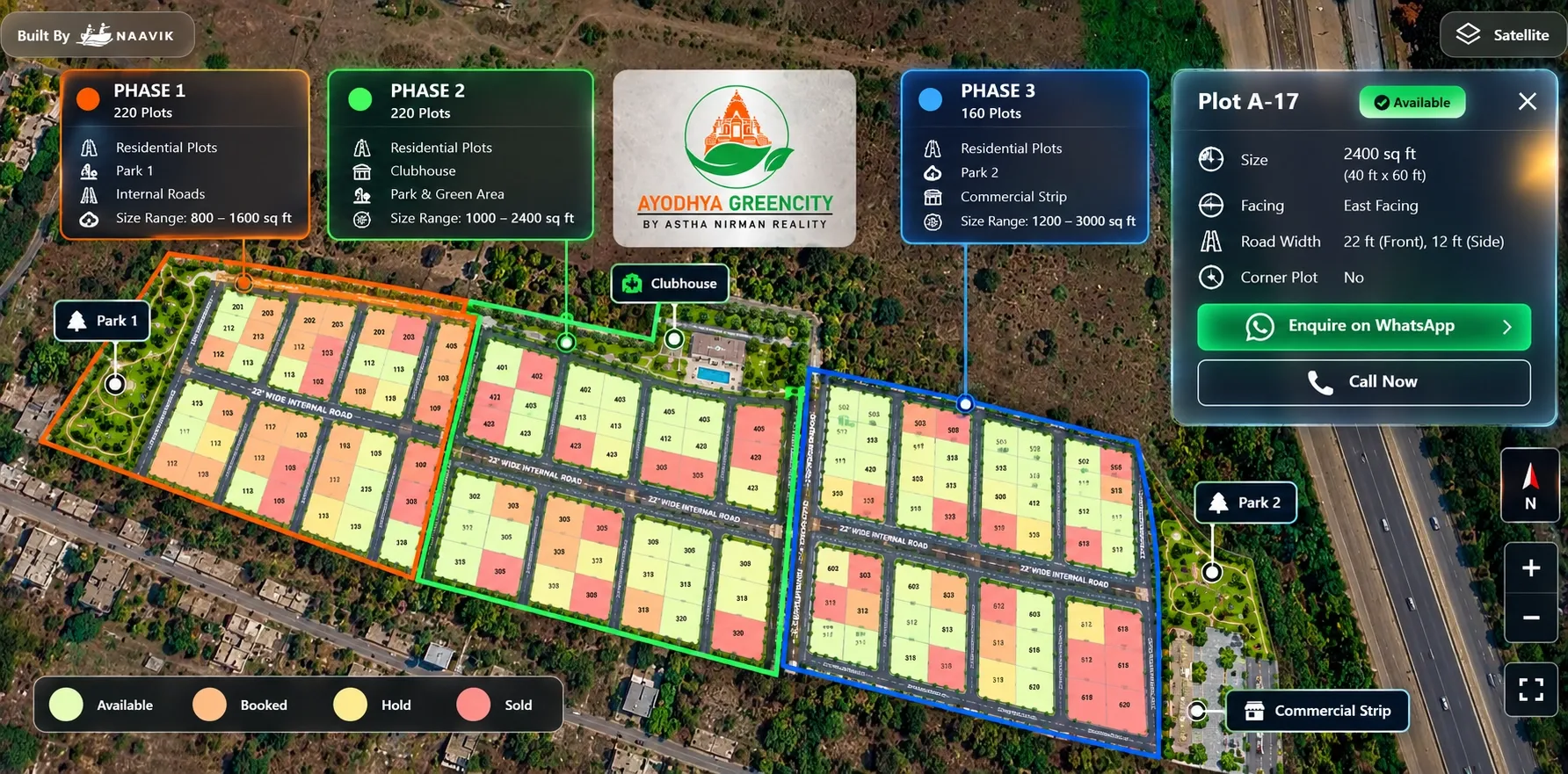
Your township has 600 plots across three phases, a clubhouse, two parks and a commercial strip. A buyer opens the masterplan PDF on their phone and sees a grid of tiny numbers. They call your sales team to ask which plots are open, where the park is and how far the gate is from the highway.
Here is the short answer. An interactive masterplan puts your whole project on a real map and lets buyers zoom from the full township down to a single plot. Each plot shows its details and live status, phases are clearly separated, and amenities and landmarks sit in their real positions. For large projects, it replaces the static PDF that becomes unreadable and outdated as the project grows.
This guide explains what an interactive masterplan is, what it should include, how to handle phases, and how to set one up for your township.
Key takeaways
- An interactive masterplan is a clickable, map-based view of your whole project, built from your approved layouts.
- Large projects need it most. The more plots, phases and plot types you have, the harder a static PDF is to read and keep current.
- Buyers should be able to move from the full township to a phase, a block and a single plot in a few taps.
- Show only approved, open phases as bookable. Label future phases clearly and keep plot-level details off them.
- One live masterplan for sales, channel partners and your website keeps every audience on the same version.
What is an interactive masterplan?
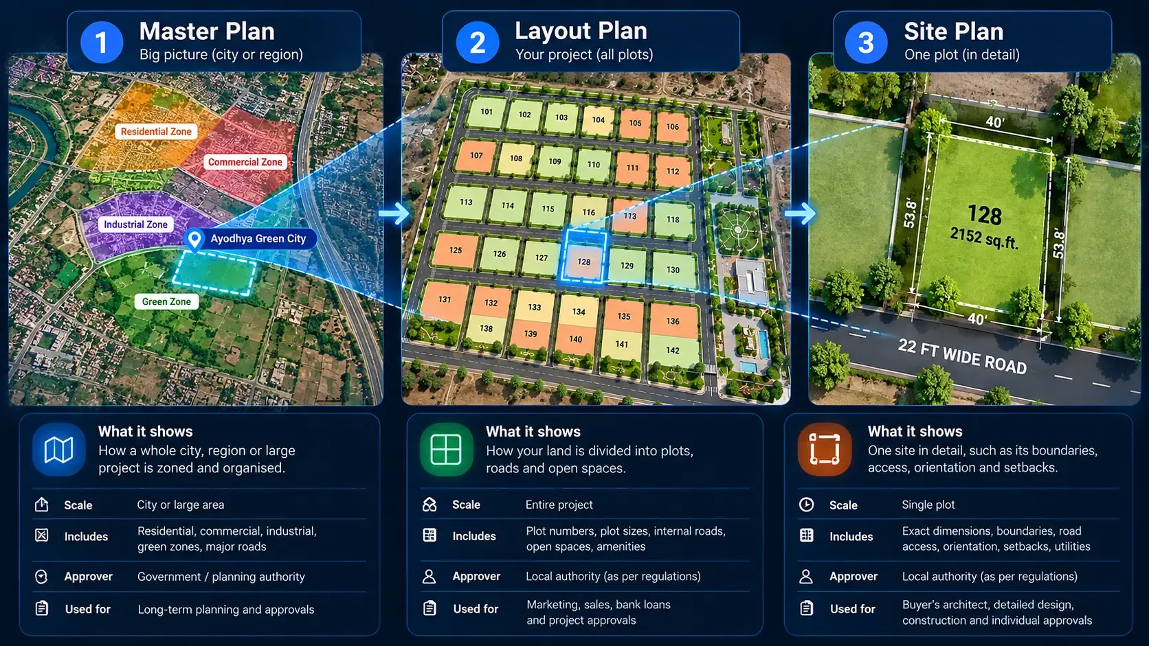
A project master plan shows how a large land parcel will be used: plotted phases, main roads, the entry gate, parks, a clubhouse and commercial areas. On most projects, it lives as a PDF or a large printed board at the sales office. If you're unsure how it differs from a layout or site plan, read our guide on site plan vs master plan vs layout plan.
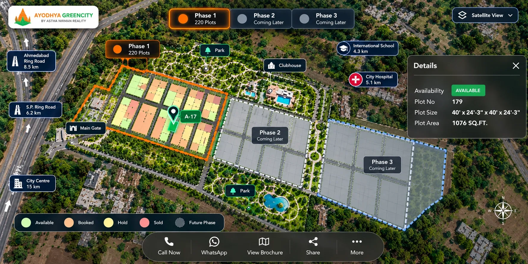
An interactive masterplan (also written "master plan") turns that drawing into something buyers can explore online. It usually has five parts:
- A real map base: the project sits over a map, so buyers see actual roads, surroundings and distances.
- Zoom levels: buyers move from the full township to a phase, then a block, then a single plot.
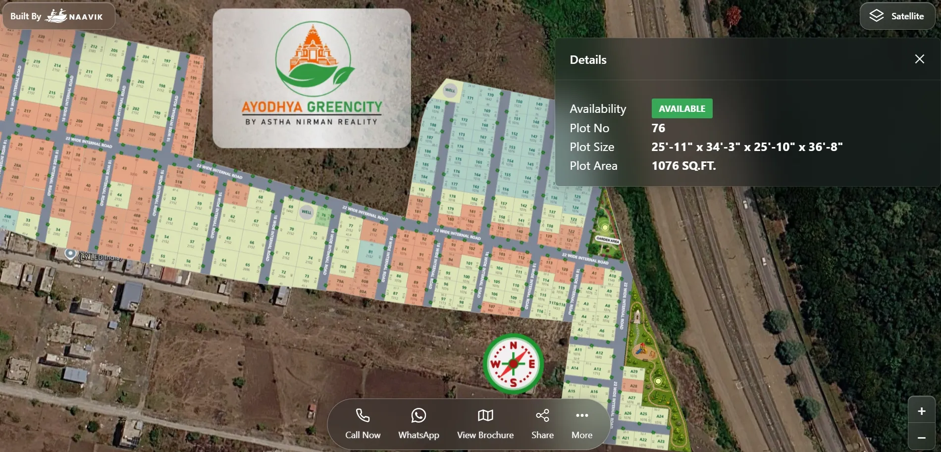
- Clickable plots: each plot opens a card with its number, size, facing, road width and status.
- Live status: plots are colour-coded as available, booked, hold or sold, and the colours change as bookings happen.
- Amenities and landmarks: parks, the clubhouse, the gate, schools, hospitals and highways are marked in their real positions.
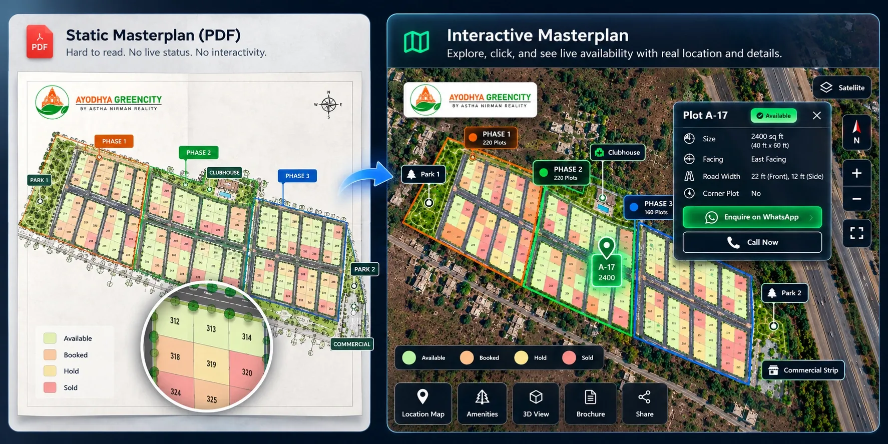
The difference is simple. A static masterplan shows what the project will look like. An interactive masterplan also shows what is available today and where it sits.
Why large projects outgrow a static masterplan
A 40-plot layout can still work as a PDF. A 600-plot township usually can't. Here is where static files start to break down on large projects.
Too much detail for a phone screen
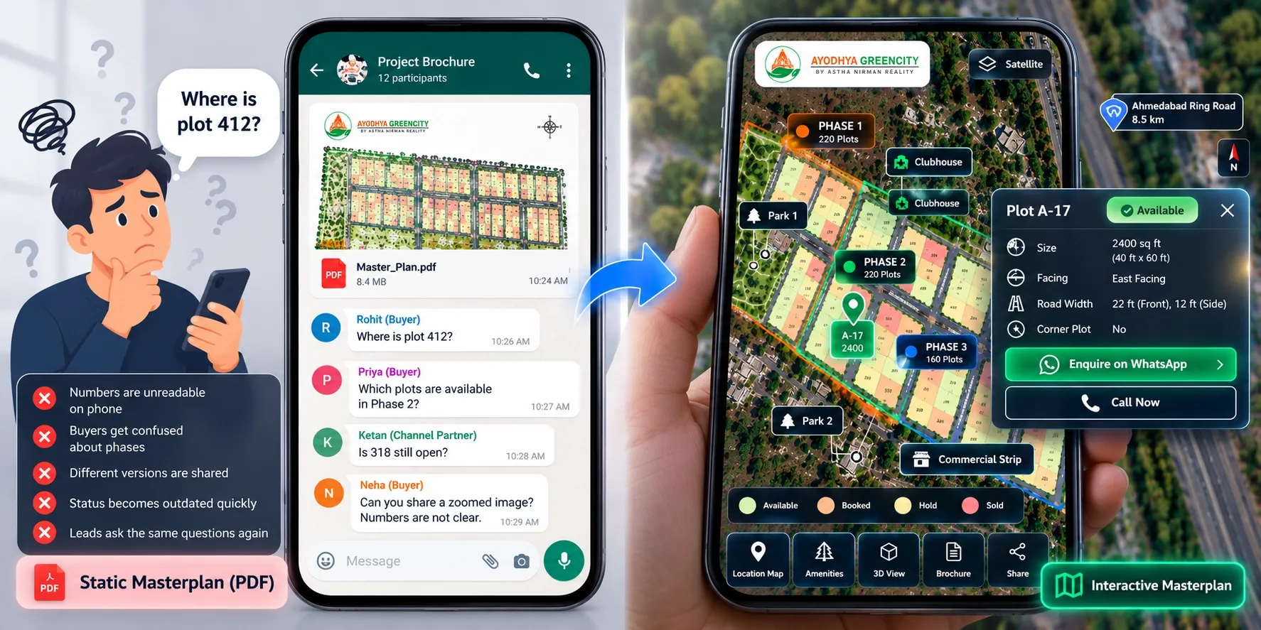
Most buyers first see your project on WhatsApp or a website, on a phone. A township masterplan shrunk to a phone screen turns into unreadable plot numbers. Buyers zoom, lose their place and give up.
Phases confuse buyers
Large projects launch in phases. When buyers see the full masterplan, they often ask for plots in phases that aren't approved or open for sale yet. Some wait for those plots instead of booking now.
Many plot types on one plan
A township may mix standard residential plots, villa plots, corner plots and a commercial strip. Each has different sizes, prices and buyers. One flat drawing makes it hard for a buyer to find the type they want.
Inventory changes every day
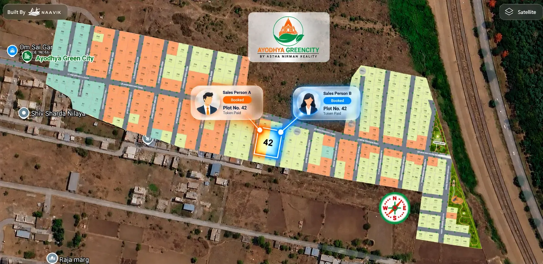
With hundreds of plots, bookings, holds and cancellations happen daily. A PDF marked with status is outdated within hours. Sales teams then quote different availability, and the risk of double booking of plots rises.
More people are selling it
Large projects often depend on dozens of channel partners. Each one forwards whatever version they received. Soon, buyers in different cities see different versions of the same project.
The site is hard to navigate in person
On a big land parcel, buyers on a site visit struggle to find a specific plot. Your sales executive spends half the visit walking them around instead of discussing the plot.
What a good interactive masterplan should include
Not every interactive map helps sales. For a township or large plotted project, check for these features and the result each one gives you.
1. Your layout placed on a real map
Buyers judge location first. Placing the masterplan over Google Maps or OpenStreetMap shows the approach road, nearby areas and how the project connects to the city.
Result: fewer calls asking "Where exactly is it?"
2. Phase-by-phase views
Buyers should be able to see the full township, then switch to one phase. Open phases show plot-level details. Future phases show only an outline and a "coming later" label.
Result: buyers focus on what they can book today.
3. Smooth zoom from township to plot
A buyer should reach any plot in a few taps, without losing track of where it sits in the project.
Result: buyers can explore a large layout on a phone without help.
4. Real-time, colour-coded plot status
Every plot shows available, booked, hold or sold, and updates as soon as your team makes a booking.
Result: one current view of inventory for sales, partners and buyers.
5. Plot details on tap
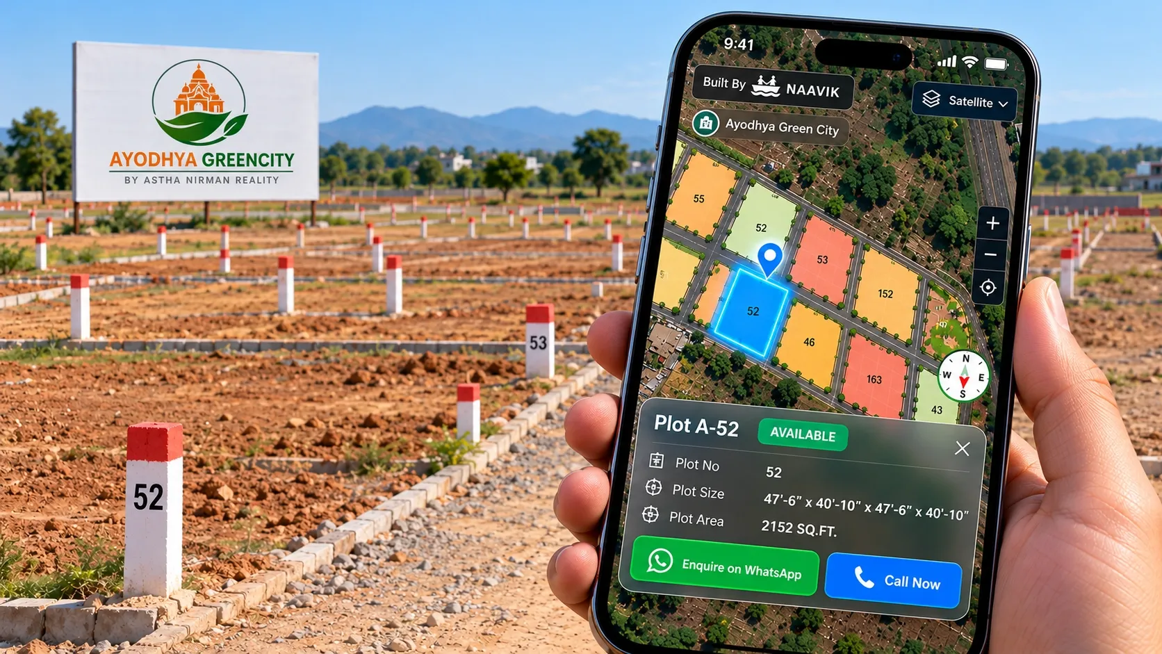
Each plot card should show plot number, size, facing, road width, plot type and status. Corner or park-facing plots should be easy to spot.
Result: your sales team spends calls on closing, not on reading out dimensions.
6. Amenities, landmarks and connectivity
Mark the clubhouse, parks, gate and internal roads inside the project. Outside it, mark schools, hospitals, stations and highways with distances.
Result: buyers understand the lifestyle and the location, not just the plot.
7. Visual media for remote buyers
A 3D view, a virtual site tour and 360° media help buyers picture the township before they visit. Our comparison of 2D vs 3D site plans explains when 3D helps most.
Result: out-of-town and NRI buyers can shortlist plots with confidence.
8. Enquiry and GPS navigation built in
Each available plot should have a WhatsApp or call option, with the plot number attached to the enquiry. On the site visit, GPS navigation can guide the buyer to the exact plot.
Result: enquiries arrive with context, and site visits run on time.
Static masterplan vs interactive masterplan: how they compare
Here is how the two compare on the points that matter most for a large project.
Plot availability
- Static masterplan: shows status as of the last export, if at all.
- Interactive masterplan: shows live status that updates with every booking.
Viewing on a phone
- Static masterplan: hard to read once the project crosses a few hundred plots.
- Interactive masterplan: buyers zoom from township to plot and tap for details.
Phases
- Static masterplan: all phases look alike, so buyers ask for plots that aren't on sale.
- Interactive masterplan: open phases are bookable; future phases are labelled "coming later".
Location context
- Static masterplan: the layout usually floats on a blank background.
- Interactive masterplan: the project sits on a real map with landmarks and distances.
Updates and sharing
- Static masterplan: every change means a new file for sales, partners and the website.
- Interactive masterplan: one link, embed or QR code always shows the current version.
Lead tracking
- Static masterplan: enquiries arrive without plot context.
- Interactive masterplan: each enquiry is linked to the plot the buyer viewed.
A static masterplan still has a place. Keep it for approvals, investor decks and the sales office wall. For day-to-day selling, the interactive version does the heavy lifting.
How to show phases without confusing buyers
Phasing is where township masterplans most often go wrong. Under RERA in India, each phase of a project is treated as a separate project for registration. Your sales material should reflect the same separation.
Follow these rules:
- Sell only from approved, registered phases. Plot numbers and sizes in the interactive view should match the approved layout exactly.
- Show future phases as outlines. Mark them "coming later" with no plot numbers, sizes or prices.
- Keep the vision visible. Buyers can still see future parks, roads and the clubhouse area, so they understand where the township is heading.
- Open new phases on the same masterplan. When Phase 2 is approved, switch its plots on in the same view. Buyers and partners keep using the same link.
This also helps with launch marketing. Our pre-launch plot marketing playbook covers how to build interest before a new phase opens.
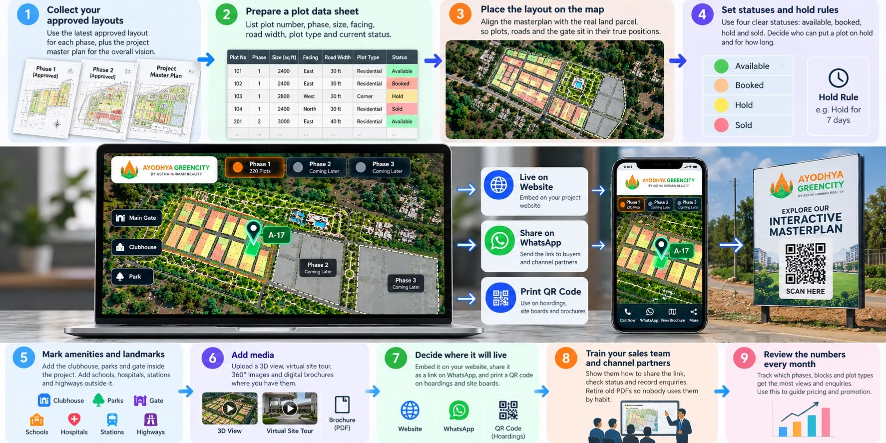
How to set up an interactive masterplan for your township
You don't need to redraw anything. You need clean inputs and a clear plan for how the masterplan will be used.
- Collect your approved layouts. Use the latest approved layout for each phase, plus the project master plan for the overall vision.
- Prepare a plot data sheet. List every plot with its number, phase, size, facing, road width, plot type and current status. Check that plot numbers match the approved layouts.
- Place the layout on the map. Align the masterplan with the real land parcel, so plots, roads and the gate sit in their true positions.
- Set statuses and hold rules. Use four clear statuses: available, booked, hold and sold. Decide who can put a plot on hold and for how long.
- Mark amenities and landmarks. Add the clubhouse, parks and gate inside the project. Add schools, hospitals, stations and highways outside it.
- Add media. Upload a 3D view, virtual site tour, 360° images and digital brochures where you have them.
- Decide where it will live. Embed it on your website, share it as a link on WhatsApp, and print a QR code on hoardings and site boards.
- Train your sales team and channel partners. Show them how to share the link, check status and record enquiries. Retire old PDFs so nobody uses them by habit.
- Review the numbers every month. Track which phases, blocks and plot types get the most views and enquiries. Use this to guide pricing and promotion.
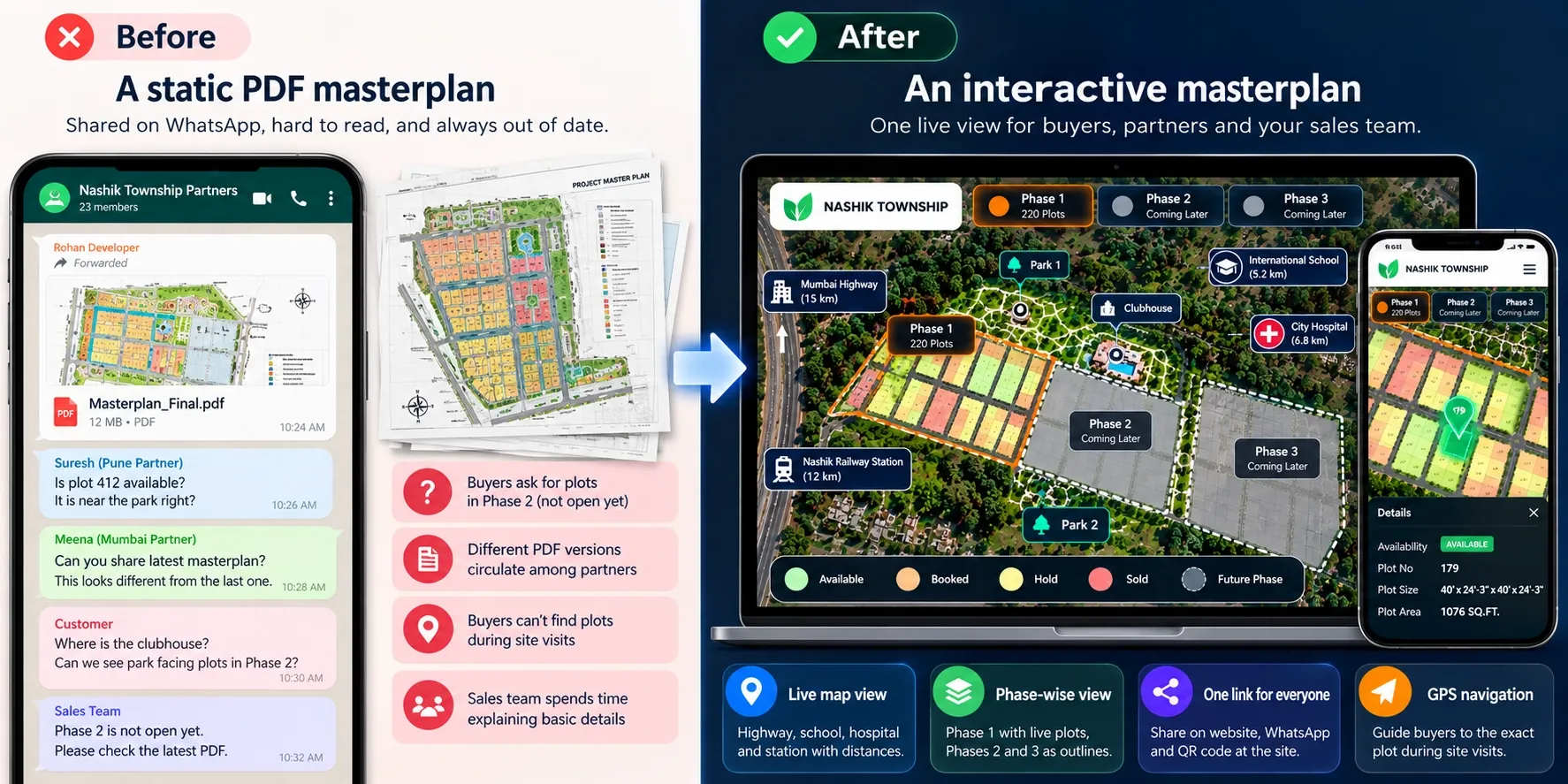
Example: a three-phase township near Nashik
This is an illustrative scenario, not a client case study.
A developer plans a 60-acre plotted township on the outskirts of Nashik. The project master plan shows three phases, about 650 plots, a clubhouse, two parks and a small commercial strip near the gate. Phase 1, with around 220 residential and villa plots, is approved and registered.
At launch, the team shares the full masterplan PDF. Problems appear within weeks:
- Buyers ask for park-facing plots in Phase 2, which isn't open yet.
- Channel partners in Mumbai and Pune forward different versions of the PDF.
- Buyers on site visits can't find their shortlisted plot on the 60-acre site.
- The sales team spends most calls explaining where the clubhouse and commercial strip are.
The developer moves the project to an interactive masterplan and makes four changes:
- Phase 1 plots go live with real-time status. Phases 2 and 3 appear only as outlines marked "coming later".
- The township sits on a map. The highway, a nearby school, a hospital and the railway station are marked with distances.
- Every partner gets the same link. Old PDFs are withdrawn, and the QR code on site boards opens the same view.
- Site visits use GPS navigation. Buyers are guided straight to their shortlisted plot.
Requests for unreleased plots drop, because buyers see clearly what is on sale. Partners stop quoting plots that are already booked. Site visits become shorter and more focused. When Phase 2 is approved, its plots are switched on in the same masterplan, and every partner already has the link.
Where Plotter by Naavik.ai fits
Plotter by Naavik.ai is plot management software that turns static layouts into interactive 3D site plans with real-time plot availability.
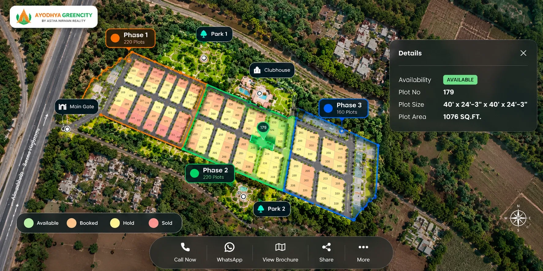
For townships and large plotted projects, Plotter places your masterplan over Google Maps or OpenStreetMap as an interactive 3D site plan over map. Every plot is clickable and colour-coded as available, booked, hold or sold. Status updates in real time as your team books plots, so sales teams and channel partners always work from the same inventory.
Nearby landmarks and connectivity are marked on the map. Buyers can take a virtual site tour, view 360° media and digital brochures, and enquire on WhatsApp or by phone. Each lead goes into the built-in CRM with plot booking management, and GPS navigation helps buyers find their plot on site. The analytics dashboard shows visitors, leads and bookings, so you can see which phases and plots draw the most interest.
You can embed the masterplan on your website, share it as a link or QR code, and use the same platform across every project you run. Shyam Infrastructure uses Plotter to manage 1,200+ units in real time. You can also explore a live project at Ayodhya Green City in Pune.
Image suggestion: A live Plotter project showing a large plotted layout over the map, colour-coded plot status and a plot details card.