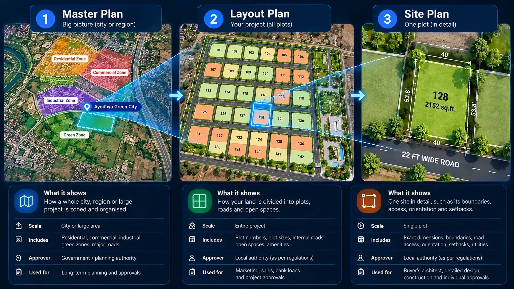
A channel partner asks for "the master plan". Your sales team sends the layout PDF. A week later, a buyer's bank asks for the approved layout, and the buyer's architect wants a site plan for one plot. Three requests, three different documents, and your team isn't always sure which one to send.
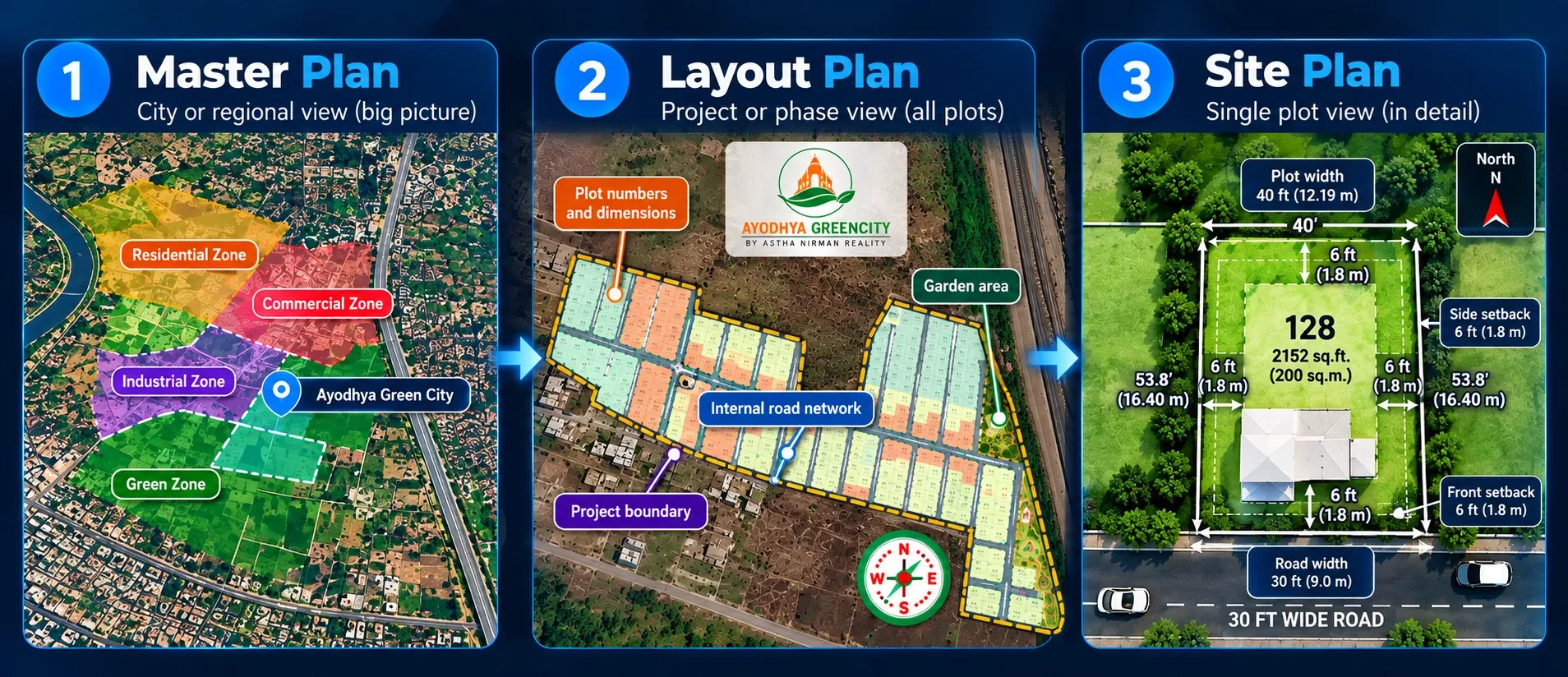
Here is the short answer. A master plan shows the big picture: how a whole city, region or large project is zoned and organized. A layout plan shows how your land is divided into plots, roads and open spaces. A site plan shows one site in detail, such as its boundaries, access, orientation and setbacks. Each plan has a different scale, a different approver and a different job.
This guide explains all three, how they connect on a plotted project, and which one to put in front of buyers, banks and channel partners.
Key takeaways
- A master plan sets the rules. It decides whether your land can be used for residential plots at all.
- A layout plan is your project's approved plot structure. It is the reference for RERA registration, sale deeds and bank loans.
- A site plan zooms into one plot or site. Buyers need it later, when they apply to build on their plot.
- In everyday sales talk, people use "site plan" and "master plan" loosely for the whole project layout. Clarify what the person actually needs before you send a file.
- Buyers understand none of these drawings easily. A buyer-facing view built from your approved layout answers their questions without changing the legal record.
What is a master plan?
The term "master plan" has two common meanings in real estate. Knowing which one someone means saves a lot of back and forth.
The city or regional master plan
This is a long-term land-use plan prepared by a town planning department or development authority. Depending on the state, it may be called a master plan, development plan or regional plan.
It divides the area into zones, such as residential, commercial, industrial, agricultural and green belt. It also marks proposed roads, road widening and land reserved for public use.
For a land developer, this plan comes first. It tells you:
- whether your land falls in a zone that allows residential plotting
- whether a proposed road or road widening cuts through your land
- what the surrounding area is planned to become over the next 10–20 years
Buyers care about it too, even if they don't ask by name. A planned ring road or industrial zone nearby changes how they see your project.
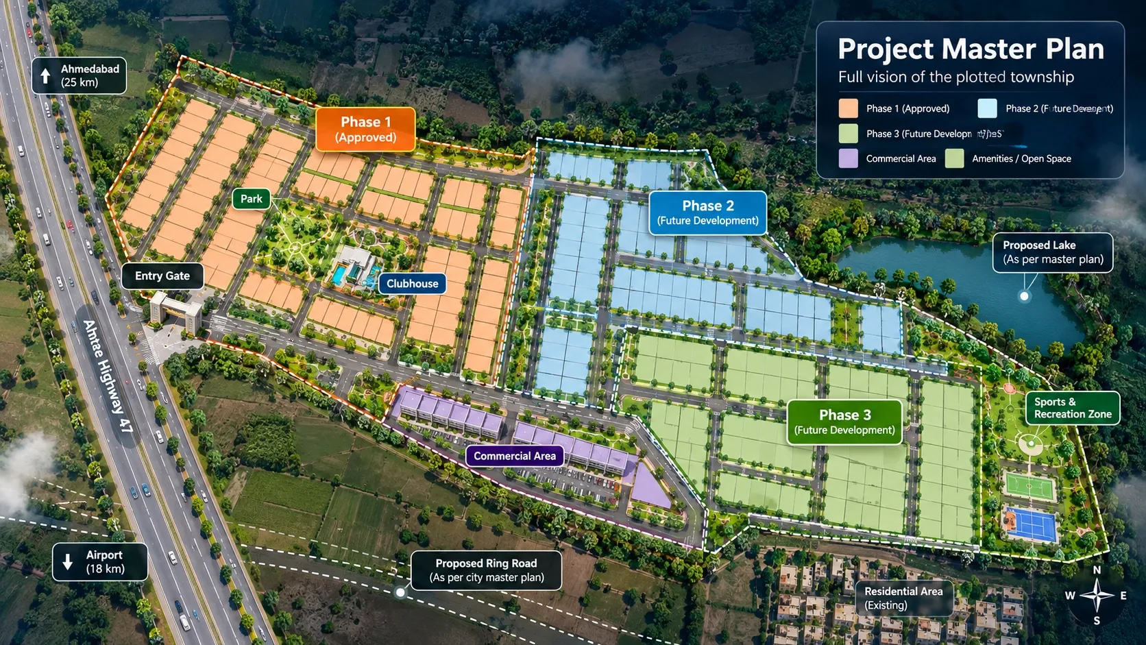
The project master plan
On large townships and phased projects, developers also prepare a project master plan. It shows the full land parcel and how it will be used: plotted phases, main roads, the entry gate, clubhouse, parks and commercial areas.
It is a planning and marketing document. It helps buyers and partners see the full vision, even when only Phase 1 has an approved layout.
What is a layout plan?
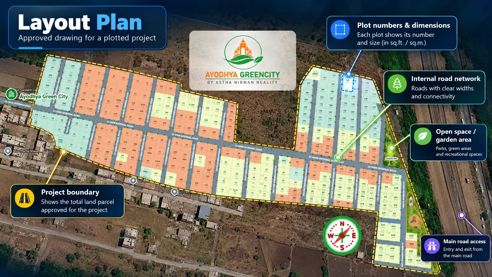
A layout plan shows how your land is subdivided. It is the drawing most plotted projects are built and sold around.
A typical layout plan shows:
- plot numbers, boundaries and dimensions
- internal road network and road widths
- open spaces, parks and amenity plots
- land reserved for utilities, such as water, drainage and electricity
- the project boundary and access from the main road
Your architect or surveyor prepares it to meet local planning norms. It then goes to the competent authority for approval. That may be the town planning department, a development authority or the local body, depending on where your land sits.
Once approved, the layout plan becomes the reference for nearly everything that follows:
- RERA registration: the RERA Act requires the promoter to submit the sanctioned layout plan when registering the project.
- Sale deeds and agreements: plot numbers and dimensions in buyer documents come from the approved layout.
- Bank loans: lenders usually ask for the approved layout as part of their checks on a plot.
- Site work: demarcation, road marking and utility lines all follow it.
What is a site plan?
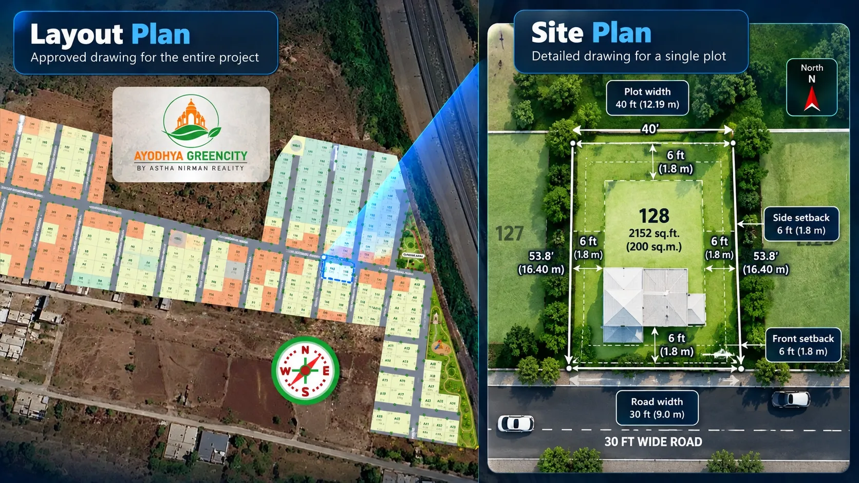
Strictly speaking, a site plan is a detailed drawing of one site. For a plotted project, that usually means a single plot.
It typically shows:
- the plot's boundaries and dimensions
- the road or roads it touches, and their widths
- the north direction and the plot's facing
- setbacks, which are the gaps a building must leave from each boundary
- where the house or building will sit on the plot, once it is designed
Buyers rarely need a site plan at booking. They need it later, when their architect applies for building permission on the plot.
Why the term gets confusing
In sales and marketing, "site plan" is often used for the whole project layout. Many developers and software tools say "site plan" when they mean "the drawing of all the plots". Our post on 2D vs 3D site plans uses the term this way too.
Neither use is wrong. But when a buyer, bank or architect asks for a site plan, ask one quick question: do they need the whole project or one plot?
Site plan vs master plan vs layout plan: side by side
Here is how the three compare on the points that matter most to a developer.
Scale
- Master plan: a city, region or large multi-phase project
- Layout plan: one project or one phase
- Site plan: one plot or one site
Who prepares it
- Master plan: the planning authority for a city plan; the developer's planners for a project master plan
- Layout plan: the developer's architect or surveyor
- Site plan: the architect, usually for the plot owner
Who approves it
- Master plan: the state or development authority (for a city plan); a project master plan may not need separate approval
- Layout plan: the town planning department, development authority or local body
- Site plan: the local body, as part of building permission
What it shows
- Master plan: land-use zones, major roads and reserved land
- Layout plan: plots, internal roads, open spaces and amenity areas
- Site plan: one plot's boundaries, access, facing and setbacks
When you need it
- Master plan: before buying land and planning the project
- Layout plan: for approval, RERA, sales, sale deeds and bank loans
- Site plan: when the plot owner wants to build
The simplest way to remember it: the master plan says what the land can be used for, the layout plan says how the land is divided and the site plan says what happens on one plot.
How the three plans connect on a plotted project
On a typical plotted development, the plans follow each other in this order:
- Check the city master plan. Confirm your land's zone and any proposed roads before you commit to the project.
- Prepare a project master plan (for large projects). Decide phases, main roads and amenity zones across the full land parcel.
- Get the layout plan approved. Finalise plot numbers, sizes, roads and open spaces for each phase.
- Register with RERA. Submit the sanctioned layout plan along with other project documents.
- Launch sales from the approved layout. Every plot you sell must match it.
- Support buyers with site plans later. When buyers start building, their architects prepare site plans for individual plots.
If you are selling before development starts, this order matters even more. Our pre-launch plot marketing playbook explains how to present a project when buyers are looking at bare land.
Which plan each person actually asks for
Different people use these words differently. Here is what they usually mean.
- Buyers: when they say "master plan" or "site plan", they usually want to see the whole project and where their plot sits. They want to know location, facing, road width, nearby amenities and whether the plot is available.
- Banks and lenders: they usually need the approved layout plan and the plot's documents, not a marketing view.
- Channel partners: they want something they can share with their own buyers. That means a clear, current view of the project with plot availability, not a technical PDF.
- Buyers' architects: they need the approved layout and the plot's details to prepare a site plan for building permission.
- Your sales team: they need one current view of the project that matches the approved layout, so they never quote a plot that is already gone.
Notice the gap. The approved layout is accurate, but buyers and channel partners struggle to read it. A city master plan is useful context, but most buyers will never open one.
Example: a two-phase plotted township near Vadodara
This is an illustrative scenario, not a client case study.
A developer is planning a plotted township on the edge of Vadodara, in two phases. Before buying the land, the team checks the city's development plan. The land falls in a residential zone, and a proposed ring road runs about two kilometres away.
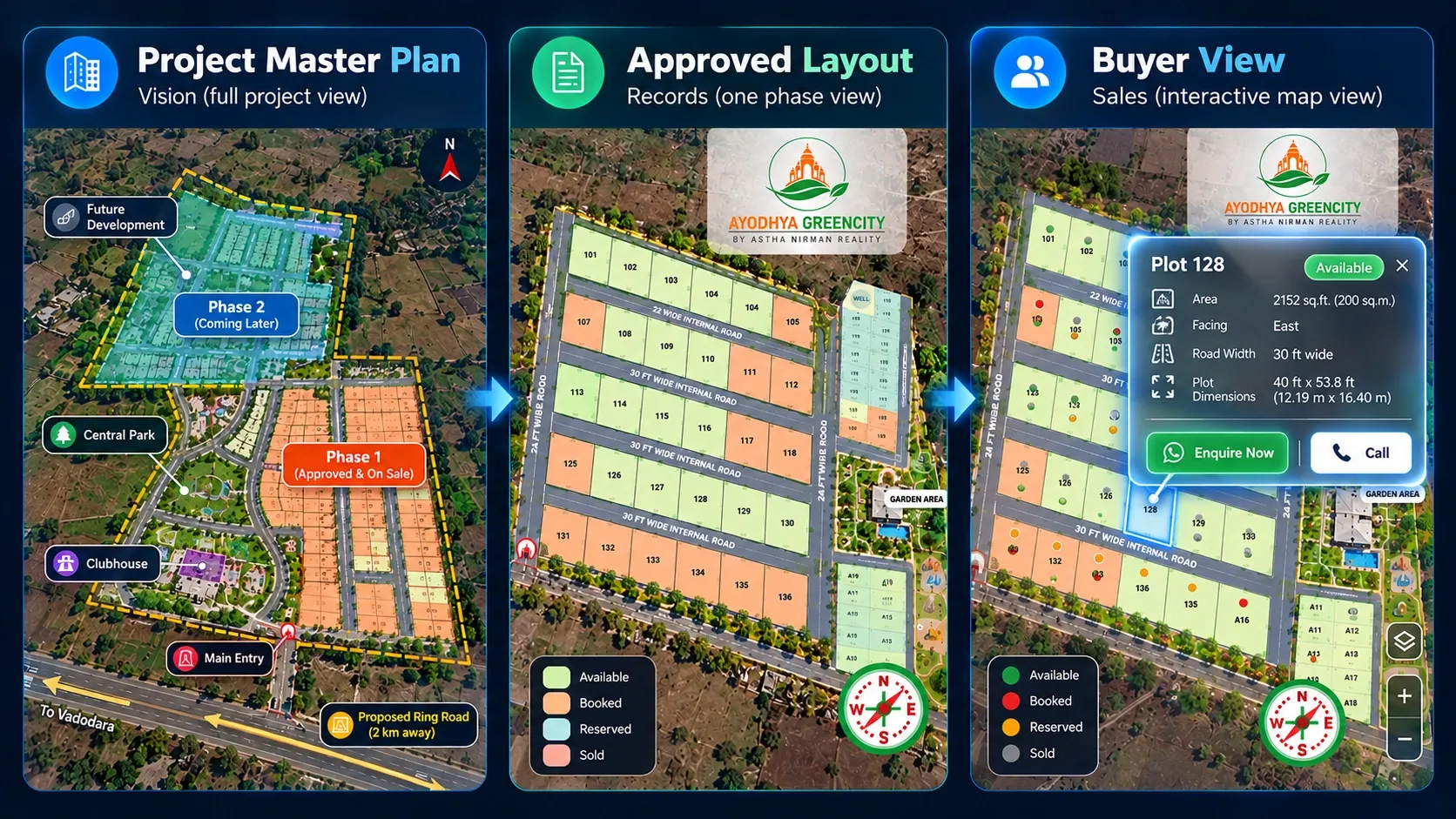
The developer prepares a project master plan showing both phases, the main entry road, a central park and a clubhouse area. Phase 1 gets layout approval for around 180 plots and is registered with RERA.
Sales then hits the usual confusion. Channel partners ask for "the master plan", and some forward the full project view to buyers who then ask for Phase 2 plots that aren't on sale yet. Buyers ask for "the site plan" when they mean the Phase 1 layout. Banks ask for the approved layout, which the team sometimes sends in an older version.
The fix is simple. The team agrees on three files and one rule:
- the project master plan, clearly labelled with "Phase 2: coming later"
- the approved Phase 1 layout, used for RERA, sale documents and banks
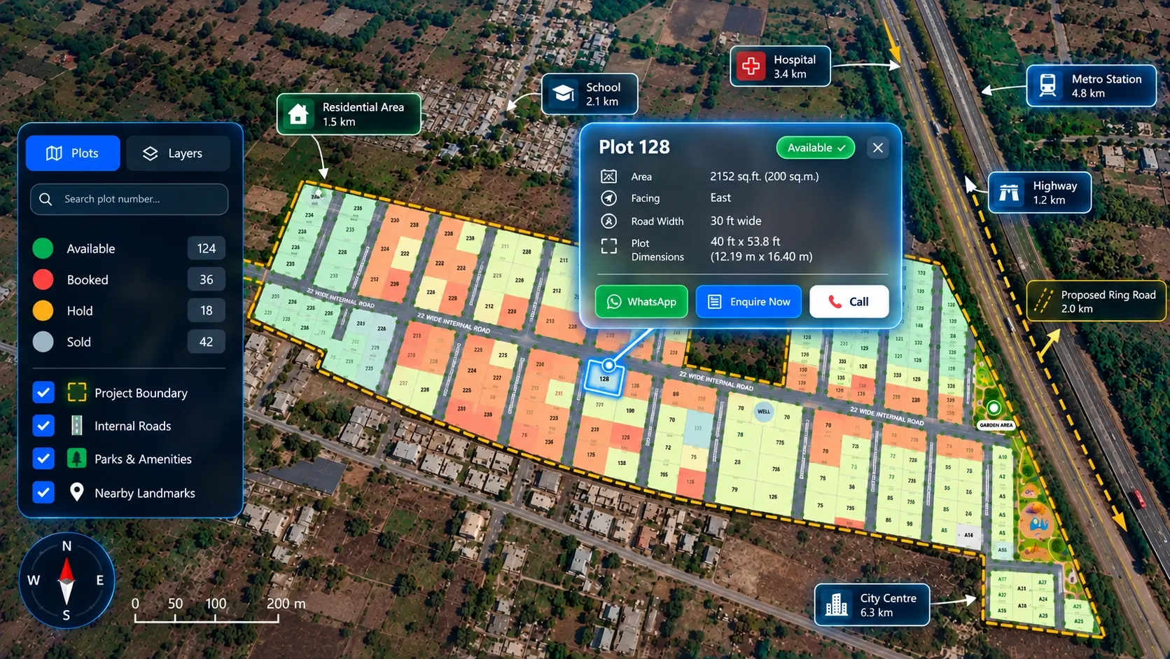
- one buyer-facing view of Phase 1, built from the approved layout, with each plot's live status, nearby landmarks and the planned ring road marked on the map
The rule: every buyer and channel partner gets the buyer-facing link first. The approved layout goes out at booking. Site plans come later, from the buyer's architect.
Common mistakes developers make with these plans
Calling every drawing a "master plan". Buyers and banks get the wrong file. Instead, name each file clearly: master plan, approved layout or site plan.
Selling from a project master plan instead of the approved layout. Plots in a future phase may change before approval. Sell only from the approved layout, and label future phases as "coming later".
Ignoring the city master plan in marketing. A planned highway, metro line or ring road nearby is a strong selling point. Show it on the map, as long as it comes from the official plan.
Letting old layout versions circulate. Outdated PDFs on WhatsApp cause wrong quotes and disputes. Share one current link instead of files.
Handing buyers technical drawings alone. Most buyers can't read a layout plan. Give them a clear buyer-facing view, and keep the approved drawing for documents.
Where Plotter by Naavik.ai fits
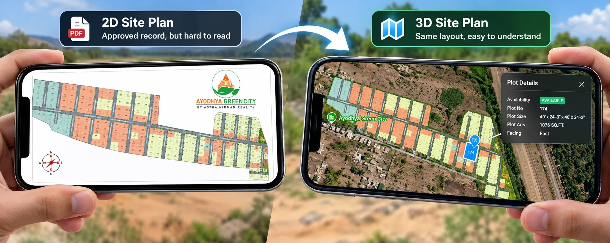
Plotter by Naavik.ai is plot management software that turns static layouts into interactive 3D site plans with real-time plot availability.
You start with your approved layout plan. Plotter places it over Google Maps or OpenStreetMap as an interactive masterplan, so buyers see every plot in its real location. Nearby landmarks and connectivity are marked on the map, which gives buyers the area context they would otherwise look for in a city master plan.
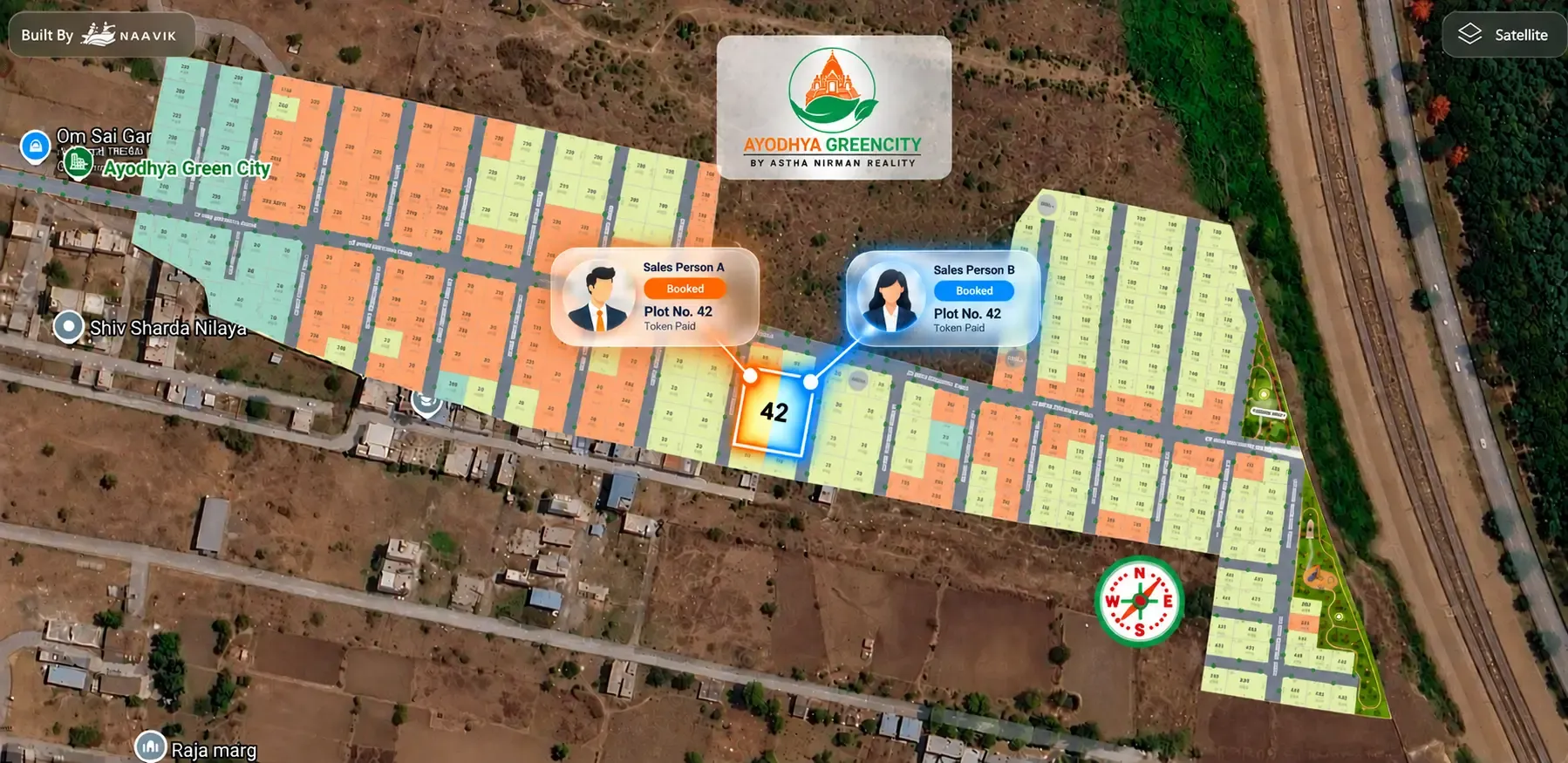
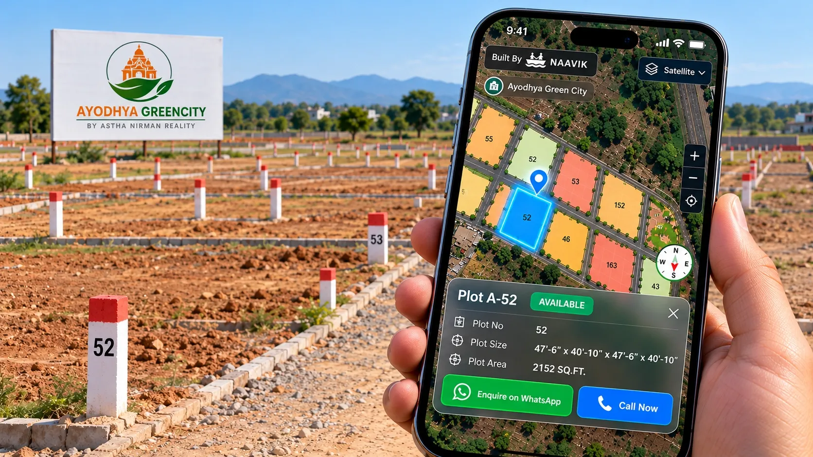
Each plot is clickable and colour-coded as available, booked, hold or sold. Buyers can check size, facing and status on their phone, and enquire through WhatsApp or call buttons. Those enquiries go into the built-in CRM with the plot attached, and the analytics dashboard shows visitors, leads and bookings. You can embed the layout on your website, or share it as a link or QR code with buyers and channel partners.
This is what an interactive site plan for real estate looks like in practice: your approved layout stays the legal record, and buyers get a view they can understand.
Our case study shows how one developer "Replaced Static PDFs With a Live Interactive Site Layout", and Shyam Infrastructure uses Plotter to manage 1,200+ units in real time. You can explore a live project at Ayodhya Green City in Pune. If you sell to buyers who can't visit often, read how to sell plots online in India.