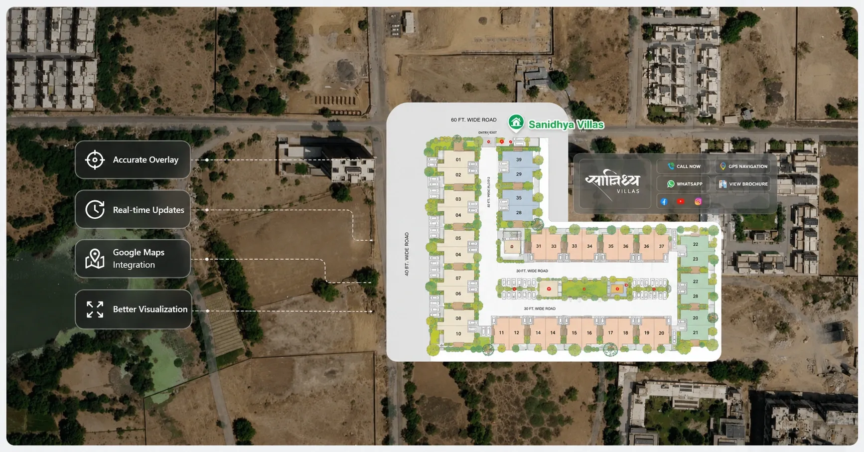
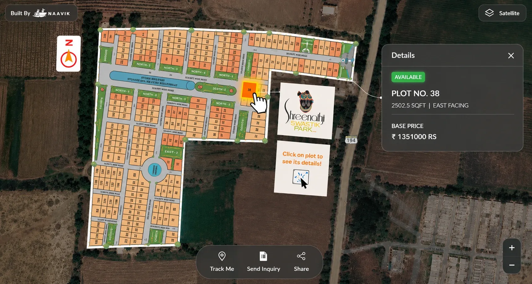
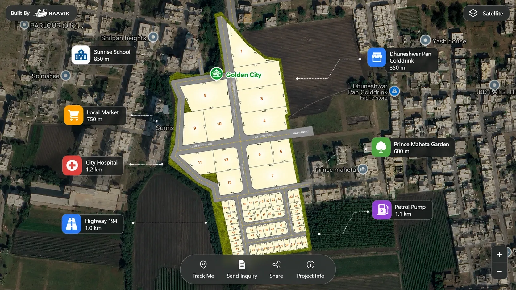
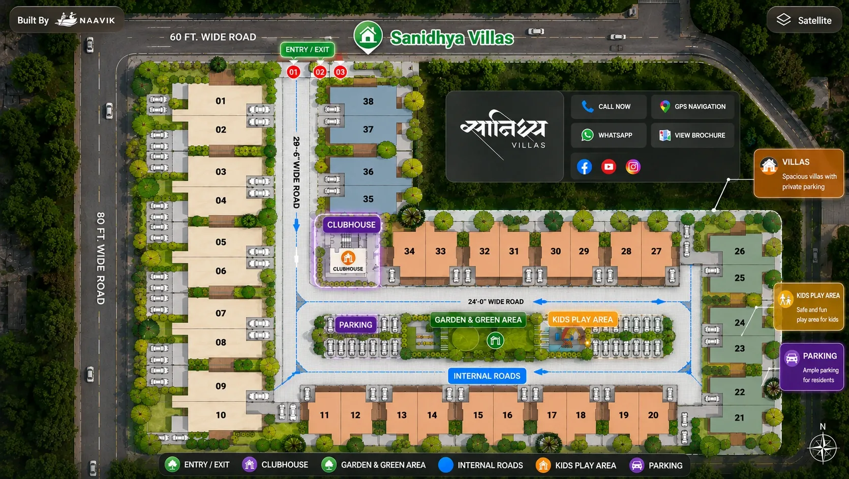
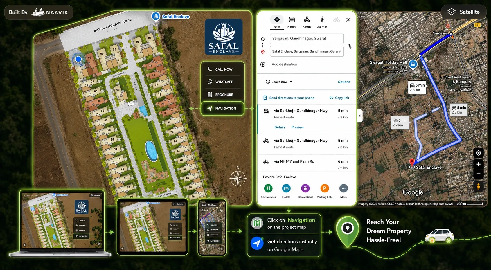
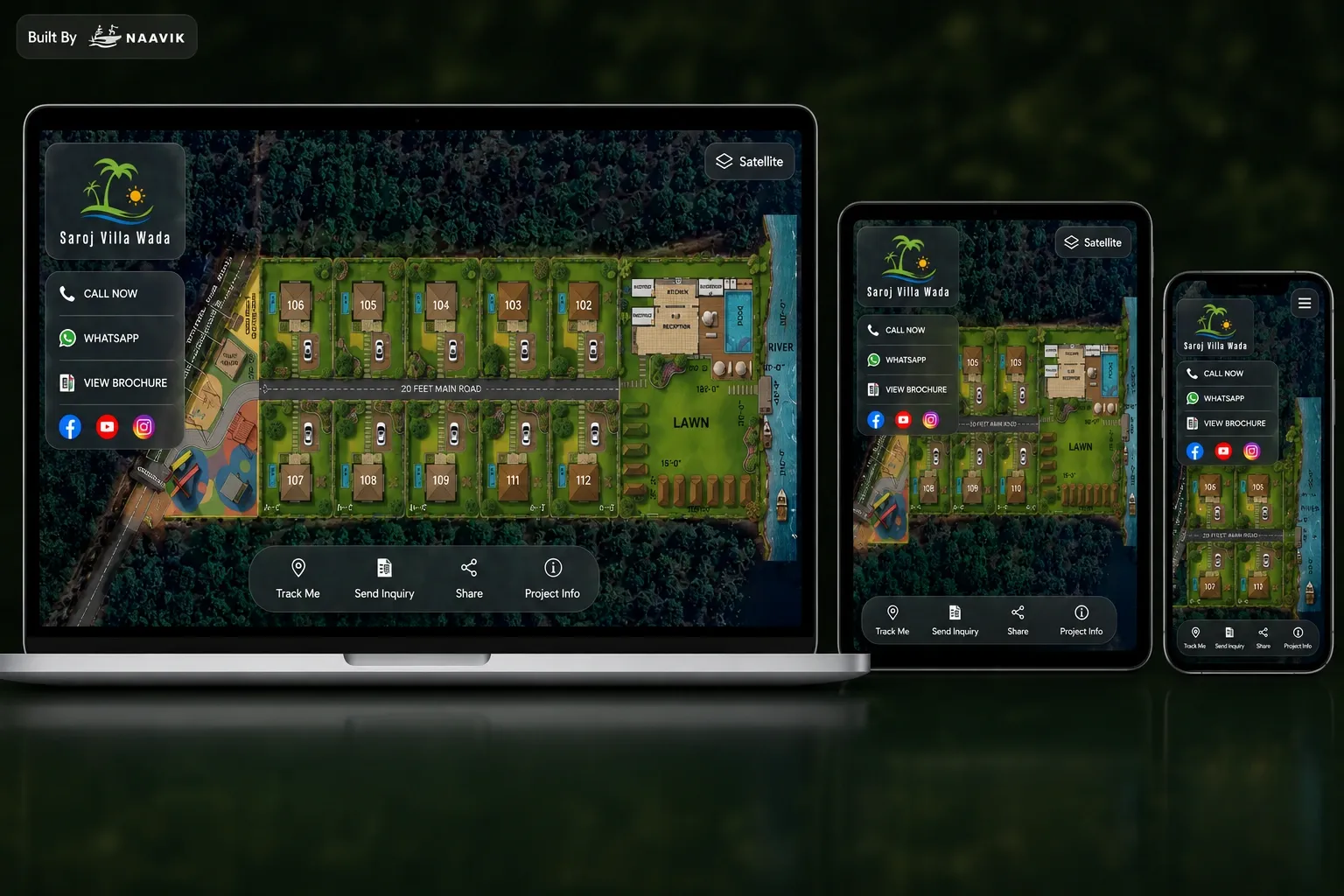
Why Overlay Property Layouts on Google Maps?

Traditional brochures and static layouts often fail to help buyers understand where a property project actually exists in the real world.

Naavik.ai bridges this gap by overlaying property layouts directly on Google Maps, allowing buyers to visualize exact project locations, nearby connectivity, surrounding infrastructure, roads, landmarks, and property positioning within an interactive digital environment.

This creates a more transparent and intuitive property exploration experience for modern buyers and investors.

Benefits of Google Maps Property Visualization

  • Real-World Location Context Help buyers understand exactly where properties are located geographically.
  • Nearby Connectivity Visualization Show surrounding roads, highways, transport access, and nearby landmarks.
  • Integrated Navigation Experience Allow users to navigate directly to projects using map-based directions.
  • Better Plot & Unit Understanding Improve buyer understanding of plot positions, orientations, and layout structures.
  • Mobile-Friendly Map Exploration Enable responsive map experiences across smartphones and tablets.
  • Improved Buyer Confidence Create transparency through location-based project visualization.

Advanced Google Maps Integration Features

  • Layout Overlay on Maps Overlay project layouts directly onto Google Maps with accurate positioning.
  • Clickable Property Units Allow users to interact with plots, villas, apartments, roads, and amenities.
  • Real Geographic Visualization Display developments within their actual surrounding environment.
  • Interactive Amenities Show gardens, clubhouses, parks, entrances, and shared facilities interactively.
  • GPS Navigation Integration Enable direct project navigation from desktop and mobile devices.
  • Responsive User Experience Provide optimized map experiences across all screen sizes.

Built for Real-World Property Experiences

  • Plotting & Villa Projects Visualize plot layouts directly on real geographic locations.
  • Apartment Communities Show apartment developments within surrounding infrastructure and connectivity.
  • Industrial Parks Map industrial layouts and warehouse developments geographically.
  • Infrastructure Projects Support smart city planning and urban development visualization.
  • Township Developments Enable large-scale master-planned community exploration.

Why Use Naavik.ai for Google Maps Property Visualization?

Naavik.ai combines interactive map experiences, precise layout positioning, responsive design, and scalable visualization technology to help developers create modern location-aware property experiences.

The platform enables buyers to connect property layouts with real-world geography, improving project understanding, transparency, navigation, and digital engagement.

Ready to Bring Your Property Layouts to Google Maps?

Create interactive Google Maps property experiences with clickable layouts, location-aware visualization, navigation, and modern buyer engagement powered by Naavik.ai.

Frequently Asked Questions