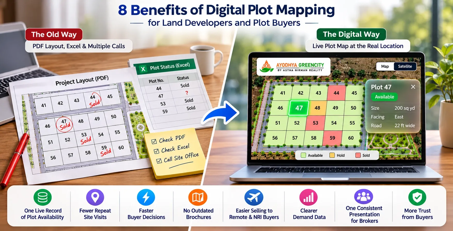
A buyer calls and asks if Plot 47 is still available. Your salesperson opens a PDF layout, then an Excel sheet, then calls the site office. Ten minutes later the answer is "I think so". By then, the buyer has started to doubt the project.
Digital plot mapping removes that gap. Its main benefits are one live record of plot availability, fewer repeat site visits, faster buyer decisions, no outdated brochures, easier selling to remote and NRI buyers, clearer demand data, one consistent presentation for brokers, and more trust from buyers. Each benefit comes from one change: your layout stops being a static file and becomes a live plot map at your project's real location.
This guide explains each benefit, what it changes for your sales, and when the gain is smaller than you'd expect.
Key takeaways
- Digital plot mapping puts your approved layout on Google Maps, with each plot clickable and showing its live status.
- For developers, the biggest gains are accurate availability, fewer wasted site visits and no reprinting of brochures.
- For sales teams and brokers, it means one answer to "is this plot available?", shared by everyone.
- For buyers, it means seeing the real location, the surroundings and current availability before they travel.
- The gain grows with project size, the number of phases and the number of people selling.
Digital plot mapping, in short
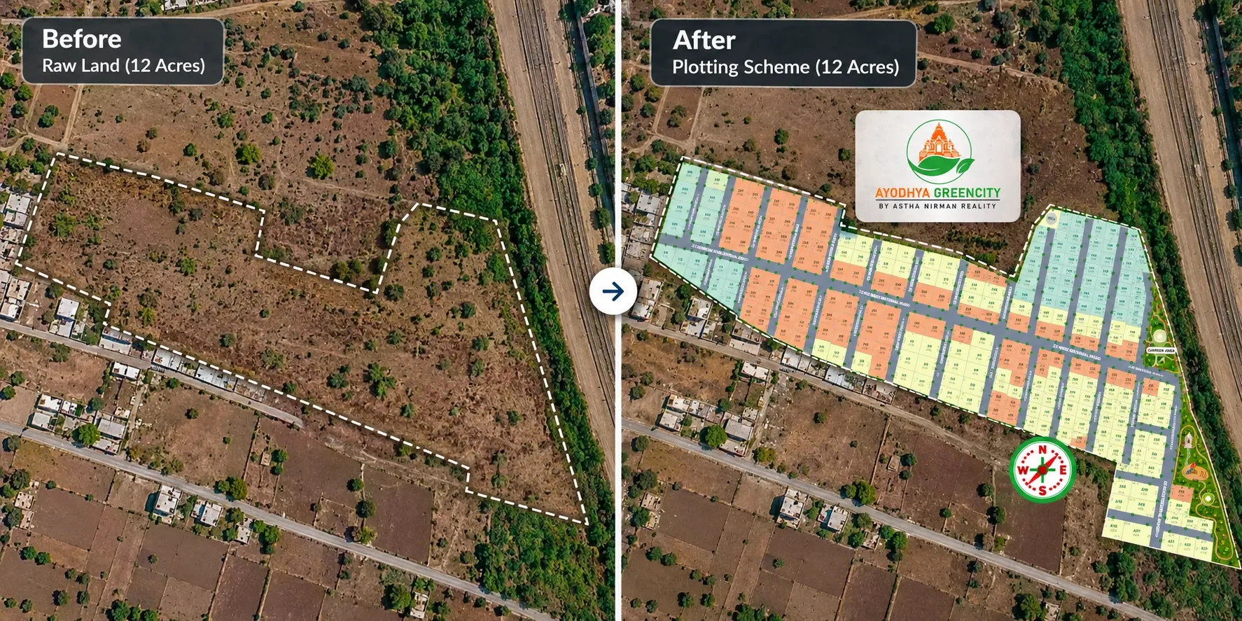
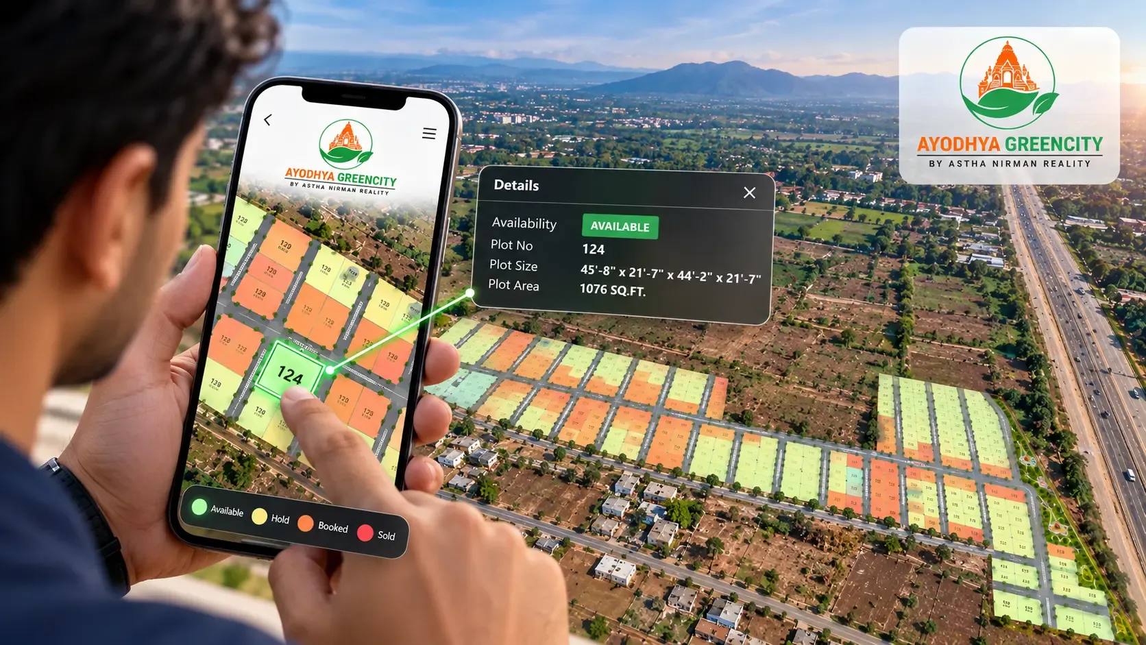
Digital plot mapping places your approved layout at its real location on a map. Each plot becomes a separate, clickable shape with its number, size, facing and status.
Status is usually shown in colour: available, booked, hold or sold. For the step-by-step process, read our guide on how plot mapping works.
Benefits for developers and sales teams
1. One live record of plot availability
Most plotted projects track inventory in Excel, a register and phone calls. Each copy drifts from the others. A plot booked at the site office at 4 pm may still show as available in a salesperson's sheet at 6 pm.
A digital plot map holds one status per plot. When a plot moves from available to booked, everyone sees the change.
What this changes for your sales:
- Salespeople check status before they quote, not after
- Fewer awkward calls telling a buyer their plot is already gone
- Far less risk of two people selling the same plot
If double bookings have already cost you a buyer, our guide on preventing double booking of plots covers the process side too.
2. Fewer repeat site visits
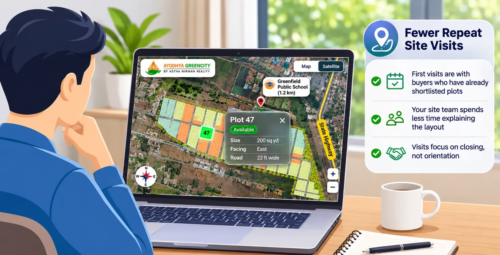
Many site visits happen only because buyers can't picture the layout from a PDF. They come to see where the plot is, how wide the road is and what lies beside it. Then they come back with family to see it again.
A plot map answers much of this before the visit. Buyers can see the plot's position, the internal roads, the open spaces and the surroundings on Google Maps.
What this changes for your sales:
- First visits are with buyers who have already shortlisted plots
- Your site team spends less time explaining the layout
- Visits focus on closing, not orientation
Site visits don't disappear. Most buyers still want to stand on the land before paying. But the visits you do get are better qualified.
3. Faster buyer decisions
Buyers delay when they are unsure. Is this plot corner or inner? Which way does it face? How far is the main road? A flat PDF makes them guess, so they ask for more time.
Clicking a plot and seeing its size, facing and position answers these questions in seconds. A 3D view adds a sense of scale that a 2D drawing can't. For more on this, see our comparison of 2D vs 3D site plans.
What this changes for your sales:
- Shorter gap between the first enquiry and the booking
- Fewer "let me think about it" pauses caused by missing information
- Buyers compare plots on facts, not on memory of a site visit
4. No outdated brochures
A printed brochure is out of date the day the first plot sells. Marketing then faces a choice: reprint often, or let buyers see the wrong availability.
A digital plot map works as a living brochure. Status updates on the map, so the link you shared last month still shows today's availability. Digital brochures can sit alongside it for project details.
What this changes for your marketing:
- Lower reprint costs as plots sell
- No mismatch between the brochure and what sales says
- One link to use on hoardings, ads and WhatsApp, often through a QR code
5. Selling to remote and NRI buyers
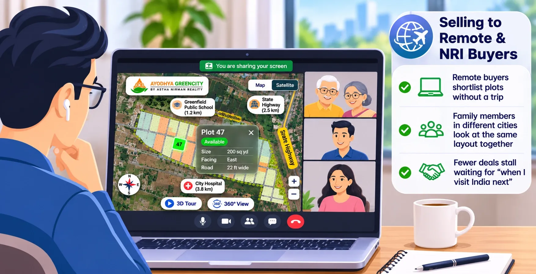
Many plot buyers are not local. Some live in another city. Many are NRIs buying for family or for retirement. They can't drop by the site on a Sunday.
A plot map gives them a view they can trust from anywhere. They see the plot, the approach road, nearby landmarks and connectivity on the map. Virtual site tours and 360° media fill in what a map alone can't show.
What this changes for your sales:
- Remote buyers shortlist plots without a trip
- Family members in different cities look at the same layout together
- Fewer deals stall waiting for "when I visit India next"
Our guide on selling plots online in India walks through the full online sales process.
6. Clearer demand data
With a PDF, you don't know which plots buyers looked at. You only see who booked. With a plot map and an analytics dashboard, you can see visitor activity, enquiries and bookings.
That shows you where demand is and where it isn't.
What this changes for your decisions:
- Spot plots or phases that get views but no bookings
- Plan offers for slow-moving areas, such as inner plots
- Decide when to open the next phase, based on what has actually sold
7. One consistent presentation for brokers
Brokers and channel partners often sell projects they didn't build. Each one may explain your layout differently, using an old PDF and their own notes.
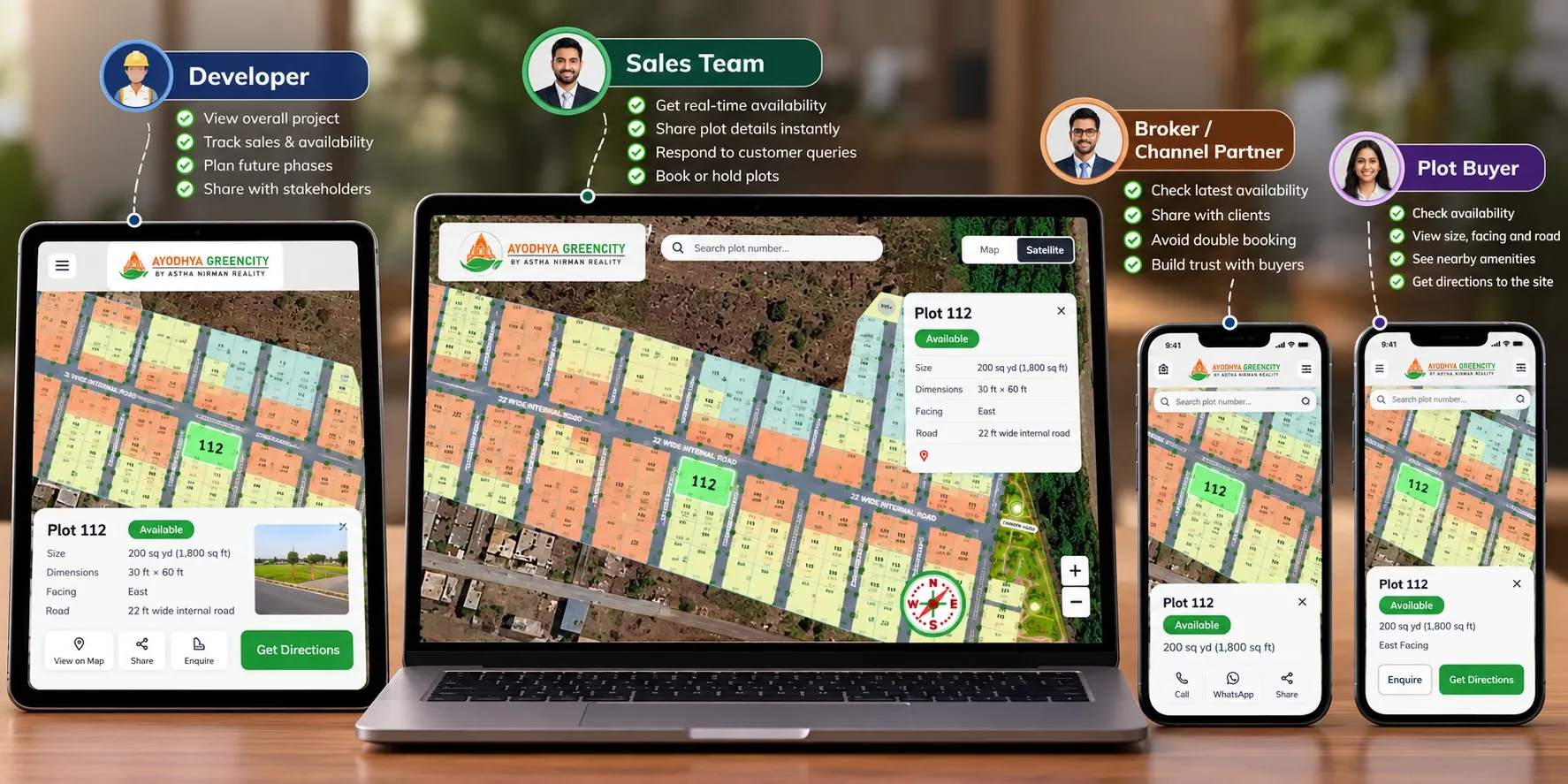
A shared plot map gives every broker the same layout and the same live status your in-house team sees. Your project is presented the same way, whoever is selling it.
What this changes for your sales:
- Brokers stop offering plots that are on hold or already booked
- Fewer disputes between brokers and your sales team
- New partners can start selling faster, with less briefing
For a role-by-role view, see who uses plot mapping.
The benefit for plot buyers
8. Buyers can trust what they see
Plot buyers have been let down before. Layouts that didn't match the land. Plots shown as available that were sold months ago. Roads on paper that never got built.
A plot map placed at the project's real location answers some of that doubt. Buyers can see:
- Where the project actually sits, relative to roads, schools and markets
- The exact plot they're interested in, with its size and facing
- Whether it is available right now
When what buyers see online matches what they see on site, trust goes up. That trust is what turns an enquiry into a booking.
Before and after digital plot mapping
Before: static layout
- Availability lives in Excel, registers and phone calls
- Buyers get a PDF on WhatsApp and need a site visit to understand it
- Brochures are reprinted or left out of date
- Brokers work from their own copies of the layout
- You know who booked, but not which plots buyers looked at
After: digital plot map
- One live status per plot: available, booked, hold or sold
- Buyers explore the layout and surroundings on Google Maps before visiting
- One link stays current as plots sell
- Brokers and your team share the same view
- An analytics dashboard shows interest, enquiries and bookings
Example: a phased project near Vadodara
This is an illustrative example, not a client case.
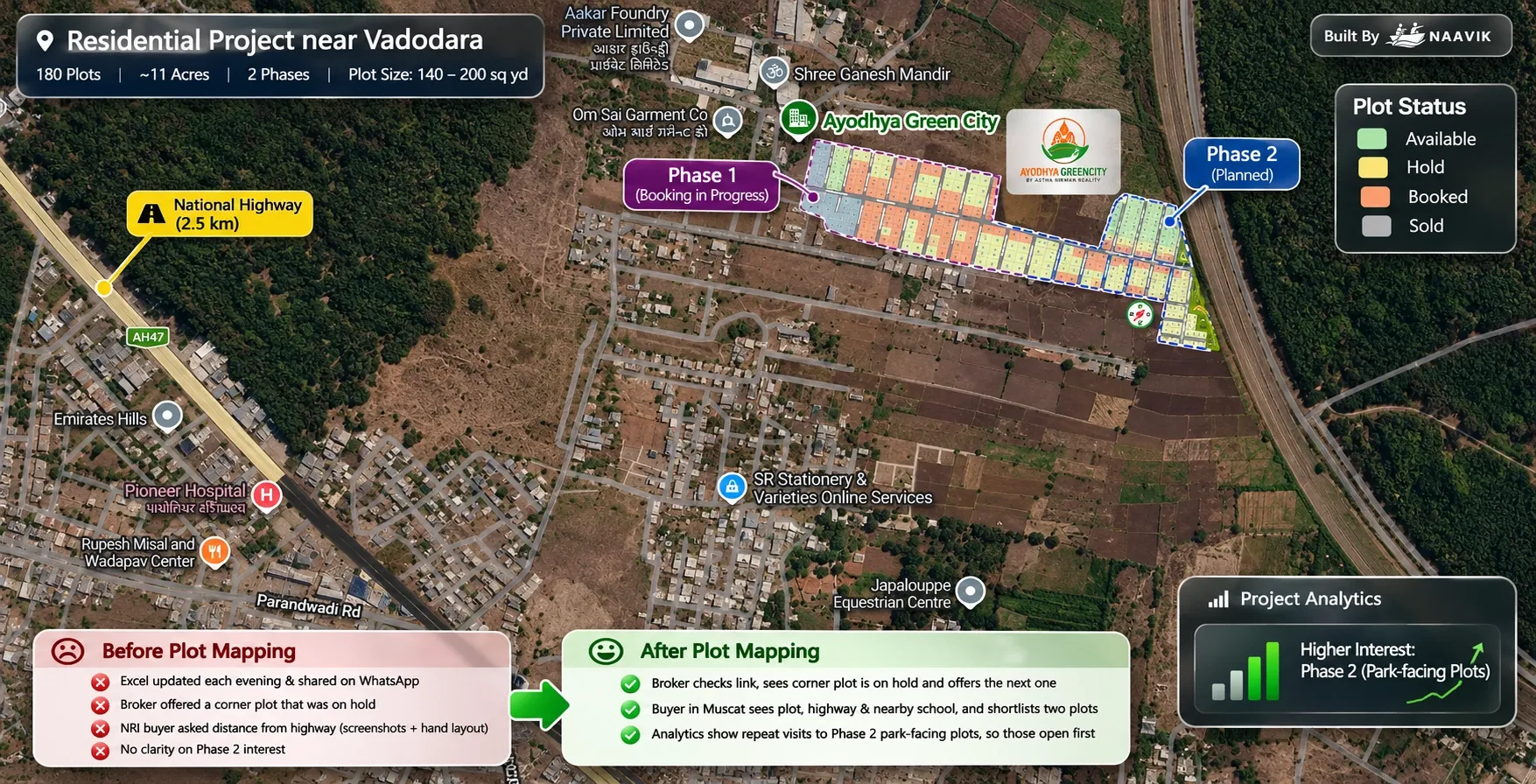
A developer has a 180-plot residential project of about 11 acres near Vadodara, in two phases. Plots range from 140 to 200 sq yd. Two in-house salespeople and four brokers sell the project. About a third of Phase 1 is booked.
Before plot mapping
- The site office updates an Excel sheet each evening and shares it on WhatsApp.
- A broker offers a corner plot that was put on hold that morning.
- An NRI buyer in Muscat asks how far the plot is from the highway, so a salesperson sends screenshots from Google Maps and a hand-marked layout.
- The developer can't tell whether Phase 2 has enough interest to open.
After plot mapping
- The broker checks the shared link, sees the corner plot is on hold and offers the next one.
- The buyer in Muscat opens the plot map, sees the highway and the nearby school, and shortlists two plots before a video call.
- The analytics dashboard shows repeat visits to Phase 2 park-facing plots, so the developer opens those first.
When the benefit is smaller
Digital plot mapping is useful for most plotted projects, but not equally.
The gain is smaller when:
- The project has only a handful of plots
- One person handles all sales and knows every plot by heart
- Almost all buyers are local and visit the site anyway
The gain is larger when:
- The project has many plots or several phases
- More than one person or broker is selling
- Many buyers are remote, from other cities or NRIs
- Plots differ a lot by facing, size or position
Even in a small project, buyers still benefit from seeing where the plot sits. But live status matters most once several people are selling at the same time.
How to get the benefits
A plot map is only as good as what goes into it. Before you start, check these:
- An approved layout: map the final approved layout, not a draft. If you're still at the planning stage, read our guide on what a plotting scheme is.
- Accurate plot details: plot numbers, sizes and facing should match your sale records.
- One owner for status: decide who updates status when a plot is booked, and update it in one place only.
- One link everywhere: use the same link on your website, hoardings, ads and with brokers, so no one works from an old copy.
- A plan for brokers: give each partner the link and explain what each status colour means.
Where Plotter by Naavik.ai fits
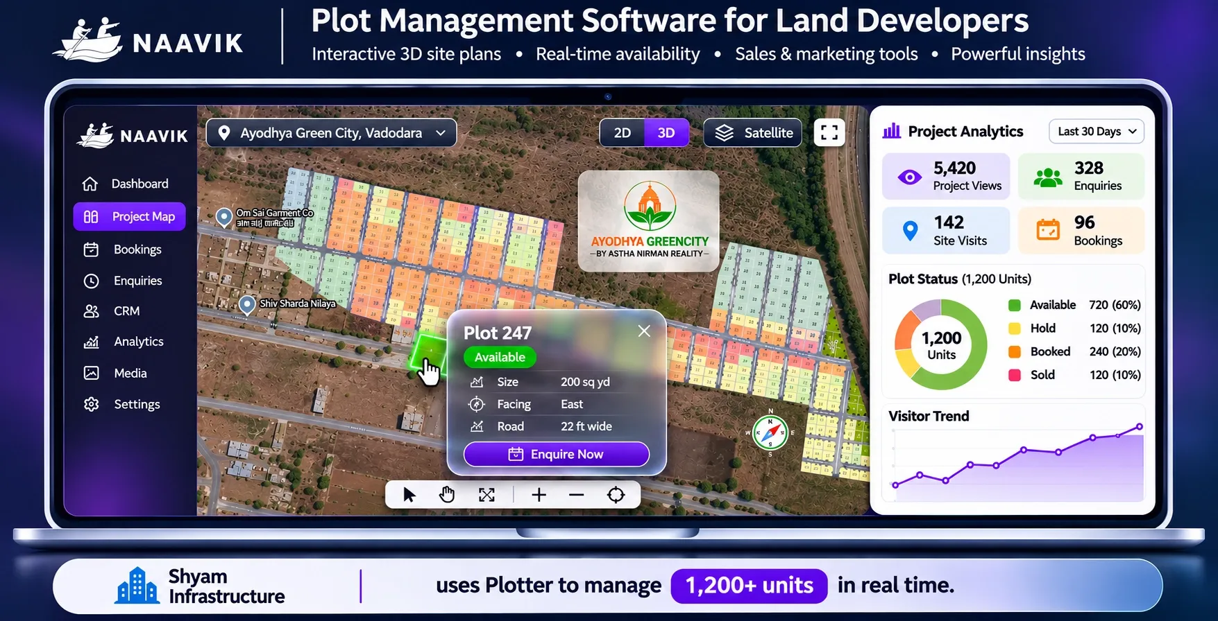
Plotter by Naavik.ai is plot management software that turns static layouts into interactive 3D site plans with real-time plot availability.
As plot mapping software built for land developers, Plotter brings these benefits together in one platform:
- Live availability: clickable plots with colour-coded status that updates in real time
- Buyer view: a 3D site plan over Google Maps or OpenStreetMap, with nearby landmarks, connectivity, virtual site tours and 360° media
- Sales tools: villa and plot booking management, a built-in CRM for every enquiry and instant alerts
- Marketing reach: digital brochures, a website embed, QR sharing and WhatsApp or call enquiry
- Insight: an analytics dashboard for visitors, leads and bookings
Shyam Infrastructure uses Plotter to manage 1,200+ units in real time.