
Interactive Property Maps vs Traditional Brochures
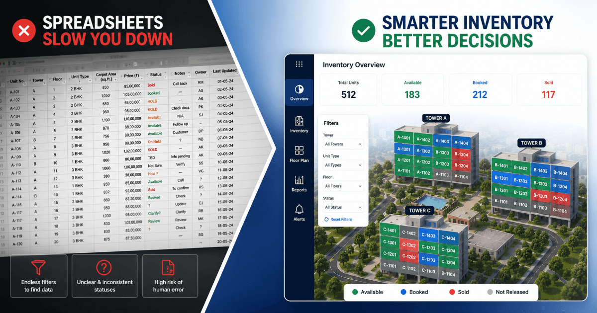
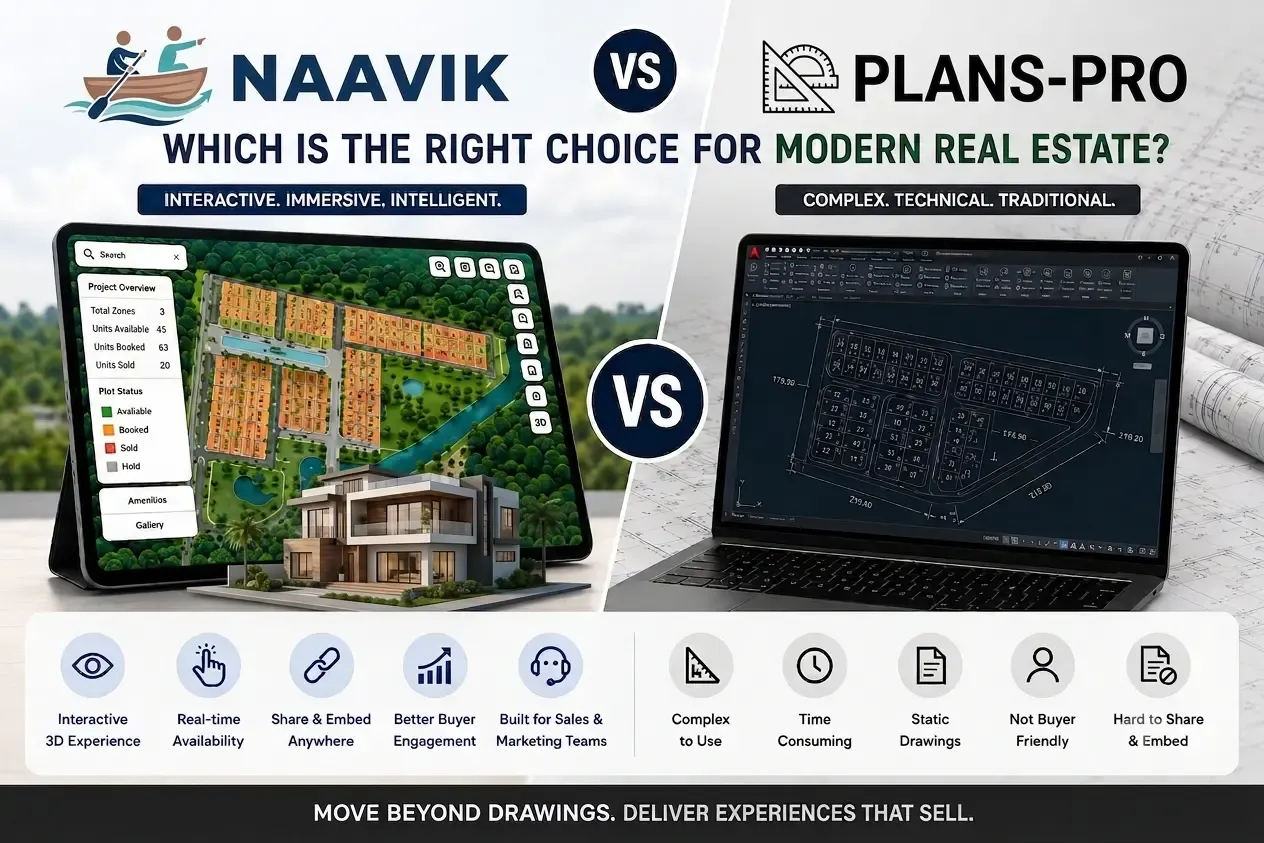
Modern buyers expect interactive project exploration, live inventory visibility, multimedia experiences, and instant access to property information.
For years, brochures were the primary way to present real estate projects.
Builders invested heavily in:
- printed catalogs
- PDF presentations
- floor plan sheets
- static layouts
- image galleries
But buyer behavior has changed dramatically.
Today’s customers are used to:
- Google Maps
- interactive applications
- visual-first experiences
- real-time information
- immersive digital interfaces
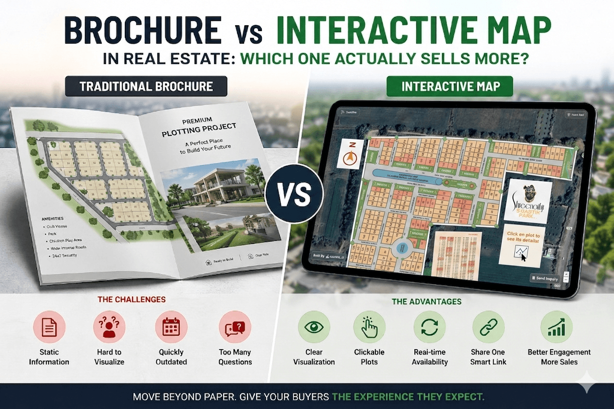
As a result, traditional brochures are no longer enough for large modern real estate projects.
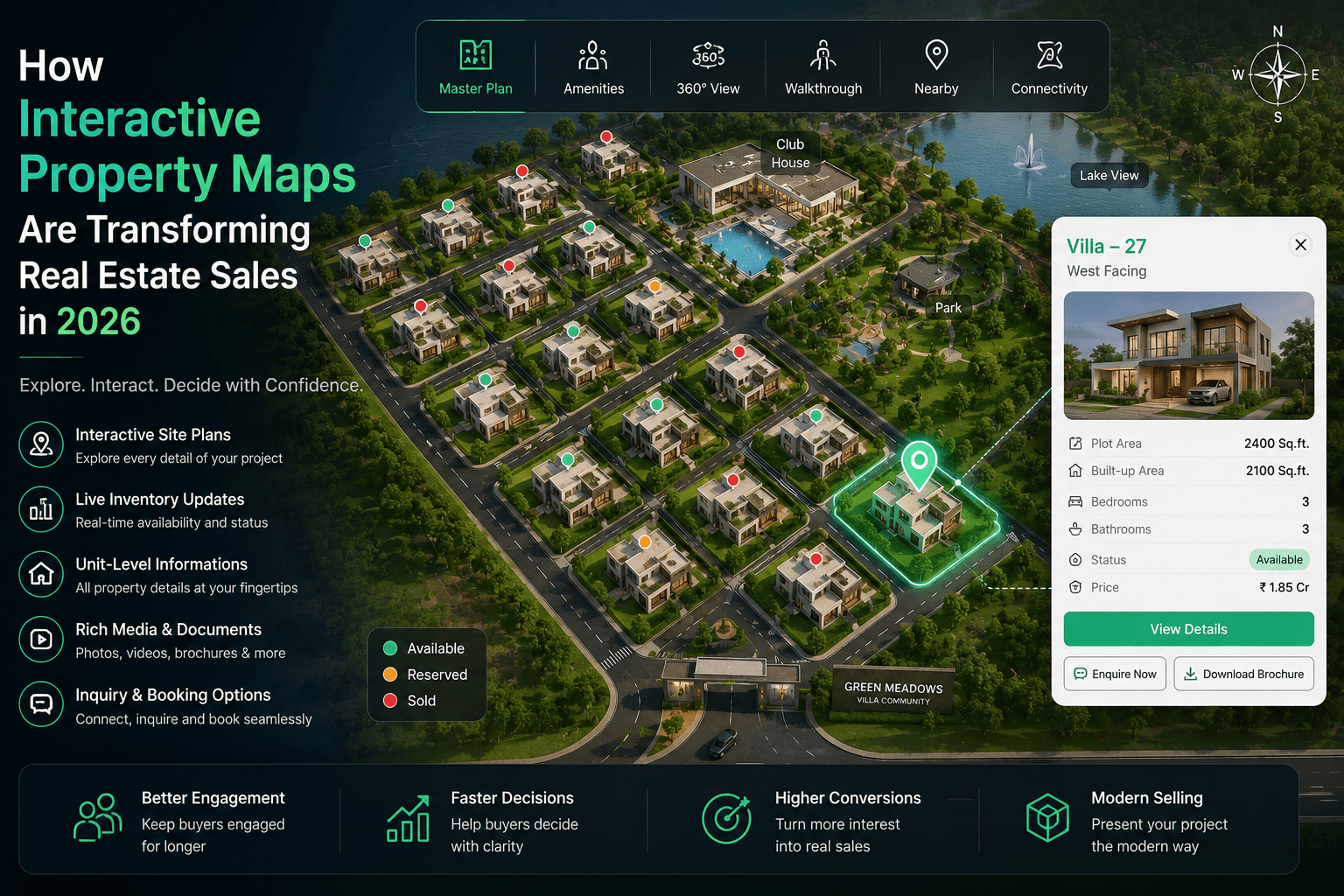
Interactive property maps are becoming the preferred way to showcase projects because they simplify property exploration and create a far more engaging buyer experience.
The Real Problem with Brochures
Traditional brochures work well for basic marketing.
But modern projects are becoming too complex for static presentation formats.
Large projects often include:
- multiple towers
- hundreds of apartments
- villa clusters
- amenities
- internal roads
- club houses
- commercial zones
- parking layouts
Explaining all of this through static PDFs becomes difficult.
Buyers frequently struggle to understand:
- which unit is where
- which inventory is available
- how towers are connected
- what surrounds the project
- how amenities are positioned
This creates confusion and slows decision-making.
What Buyers Experience with Traditional Brochures
Typical Buyer Journey
Step 1 Open brochure PDF
Step 2 Search for unit manually
Step 3 Call sales team for availability
Step 4 Ask for floor plan separately
Step 5 Request pricing again
Step 6 Get confused between layouts
What Buyers Experience with Interactive Property Maps
Modern Interactive Journey
Step 1 Open interactive map
Step 2 Click directly on unit
Step 3 See:
- pricing
- area
- facing
- availability
- images
- videos
- brochures
instantly
Step 4 Submit inquiry directly
Step 5 Compare multiple options visually
This creates a much faster and smoother buying experience.
Visual Project Understanding Changes Everything
One of the biggest advantages of interactive maps is visual clarity.
Instead of reading multiple pages, buyers can instantly understand:
- project layout
- road connectivity
- open spaces
- amenities
- tower positioning
- villa arrangement
- available inventory
This is especially valuable for:
- township projects
- villa communities
- plotted developments
- premium gated communities
Interactive Unit Experiences Create Higher Engagement
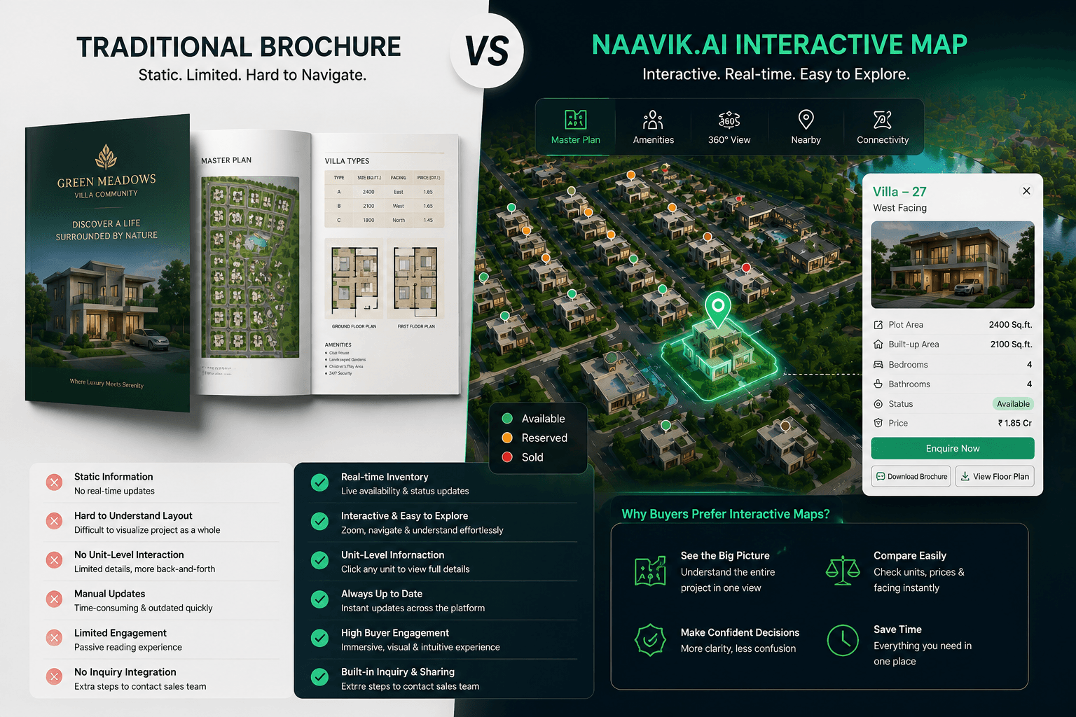
Modern interactive property platforms allow every unit to become its own digital experience.
When users click on a unit, they can access:
Rich Property Information
- images
- videos
- brochures
- floor plans
- elevation views
- pricing
- area details
- facing direction
- amenities
- legal documents
Buyer Actions
- inquiry forms
- WhatsApp contact
- brochure download
- booking inquiry
- callback request
Everything becomes accessible from one interface.
Why Interactive Maps Feel More Premium?
Modern buyers associate better digital experiences with better projects.
Interactive property visualization helps projects feel:
- more advanced
- professionally managed
- easier to explore
- more transparent
- technologically modern
This improves overall project perception.
Brochures Become Outdated Quickly
One major limitation of brochures is maintenance.
Whenever:
- pricing changes
- units are sold
- inventory updates
- layouts change
developers must regenerate documents manually.
Interactive maps solve this problem through centralized visualization and real-time updates.
This is especially important for projects with large inventories.
Mobile Experience Matters More Than Ever
Most property buyers now explore projects on mobile devices first.
Traditional PDFs often perform poorly on:
- smartphones
- tablets
- smaller screens
Interactive property maps provide:
- responsive navigation
- touch interaction
- faster exploration
- better visual engagement
This creates a far more user-friendly mobile experience.
Interactive Maps Improve Sales Efficiency
Interactive visualization doesn’t only help buyers.
It also helps sales teams.
Sales representatives can:
- explain projects faster
- show inventory visually
- compare units instantly
- reduce repetitive explanations
- improve remote presentations
This improves sales communication significantly.
The Future of Real Estate Presentation
Brochures are not disappearing completely.
But they are no longer enough as the primary property exploration tool.
Modern buyers increasingly expect:
- interaction
- instant information
- visual exploration
- immersive experiences
- responsive digital interfaces
Interactive property maps align much better with these expectations.
How Naavik.ai Helps Developers Modernize Property Presentation
Naavik.ai helps developers transform traditional layouts into immersive interactive experiences.
The platform enables:
- interactive property maps
- clickable site plans
- inventory visualization
- multimedia-rich unit experiences
- responsive project exploration
- visual property storytelling
Naavik.ai helps modern real estate projects deliver better customer engagement through advanced interactive geospatial experiences.
Final Thoughts
Traditional brochures helped shape real estate marketing for many years.
But buyer expectations in 2026 are very different.
Customers now prefer:
- interactive exploration
- live inventory visibility
- visual navigation
- instant access to information
Interactive property maps help developers provide all of this through a single immersive experience.
For modern real estate projects, interactive visualization is no longer just a premium feature — it is becoming a competitive necessity.